

You are here
Avalanche Advisory for 2013-02-22 06:57:33
- EXPIRED ON February 23, 2013 @ 6:57 amPublished on February 22, 2013 @ 6:57 am
- Issued by Nick Meyers - Shasta-Trinity National Forest
Bottom Line
A variety of snow conditions exist today in the forecast area. Overall low to moderate avalanche danger prevails. We received 4-6 inches of new snow over the week with strong winds from various directions. While some areas have been scoured down to old snow surface by winds in the past several days, instabilities will be found in isolated wind loaded areas near ridgetops, bowls, rock outcrops, chutes and gullies


Avalanche Problem 1: Wind Slab
-
Character ?

-
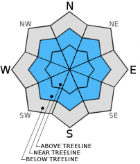
Aspect/Elevation ?
-
Likelihood ?CertainVery LikelyLikelyPossible
 Unlikely
 -
Size ?HistoricVery LargeLargeSmall

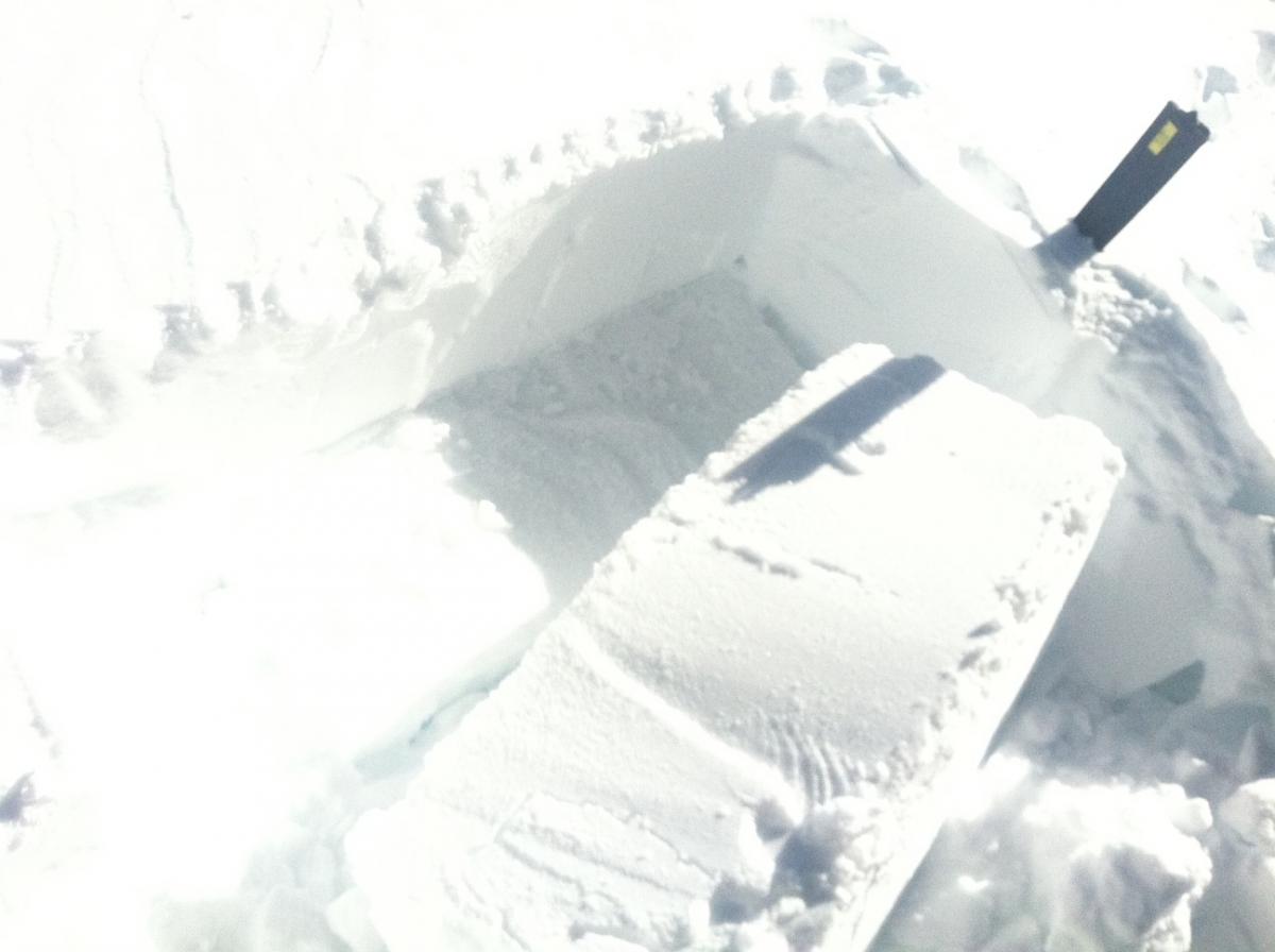
Isolated pockets of wind deposited snow on all aspects, especially near and above treeline. Easy failures were found within wind slab layers yesterday. Slabs could be shallow to up to 2 feet thick. Failures propagated on a layer of facets, below and above a buried crust layer, above 30-40 cm deep.
Recent Observations
2-20-13 - Avalanche Gulch, Spring Hill area, small wind slab avalanche (R1-D2), unknown trigger
2-20/2-21 - Numerous reports of "whoomfing" and shooting cracks near and above treeline on Mt. Shasta: Giddy Giddy gulch, Anaconda, The Promise Land areas.
2-21-12 - Castle Lake area, NW aspect, 30 degree slope on Middle Peak... CT-6 / ECT - 4 - Q1/2 - Failures near buried crust on layer of facets, above old snow, about 30-40 cm down from surface, wind deposited snow, full propagation hard slab
Weather and Current Conditions
Weather Summary
A winter storm moves over land today, however the Mt. Shasta area will lie on the flanks of this one with most of the juice heading north of here. The Crater Lake area looks to host the most impressive precip totals. This short lived storm should arrive later this afternoon and give us up to .14 inches of water by tomorrow, which could mean a couple inches of new snow for Saturday skiers. Snow levels are going to start at 4,500 to 5,000 feet and drop quickly by tonight. Mountain winds will increase today and into tomorrow out of the northwest.
WEATHER STATIONS - (last 24 hours):
In Mt. Shasta City at 0500, we have mostly clear skies and a current temperature of 30 F.
On Mt. Shasta: In the Old Ski Bowl (7,600') on the south side of Mt. Shasta, we have a current temperature of 32 F. Snow on the ground totals 101" inches with no new snow and 2" settlement. Temperatures have ranged from 10 F to 32 F. At Grey Butte (8,000') on the south side of Mt. Shasta winds averaged 6 mph from the SE with a max gust of 21 from the SE. The current temperature is 19 F and temps have ranged 11 F to 25 F.
Castle/Mt. Eddy: Castle Lake - Castle Lake is hosting a current temp of 24 F. In the last 24 hours temperatures have ranged from 17 F to 33 F. Snow depth measures 48" inches with no new snow and 1" settlement. On Mt Eddy, we have 66" inches of snow on the ground with no new snow and 2" settlement. The current temperature reads 25 F with temps ranging from 16 F to 28 F. Winds have been SE, averaging 2 mph and gusting to 13 mph from the SE.
| 0600 temperature: | 32 |
| Max. temperature in the last 24 hours: | 32 |
| Average wind direction during the last 24 hours: | SE |
| Average wind speed during the last 24 hours: | 6 mi/hr |
| Maximum wind gust in the last 24 hours: | 21 mi/hr |
| New snowfall in the last 24 hours: | 0 inches |
| Total snow depth: | 101 inches |
Two Day Mountain Weather Forecast
Produced in partnership with the Medford NWS
| For 7000 ft to 9000 ft | |||
|---|---|---|---|
|
Friday (4 a.m. to 10 p.m.) |
Friday Night (10 p.m. to 4 a.m.) |
Saturday (4 a.m. to 10 p.m.) |
|
| Weather | Partly cloudy, becoming mostly cloudy | Storm arriving, snow showers overnight, .14 inches water expected, a couple inches of snow | Lingering snow showers, clearing |
| Temperature (°F) | 40 | 18 | 33 |
| Wind (mi/hr) | Northwest 10-20 mph | Southwest 15-25 mph | Northwest 20-30 mph |
| Precipitation SWE / Snowfall (in) | / .5 | / 1-3 | / .5 |
| For 9000 ft to 11000 ft | |||
| Friday | Friday Night | Saturday | |
| Weather | Partly cloudy, becoming mostly cloudy | Storm arriving, snow showers overnight, .14 inches water expected, a couple inches of snow | Lingering snow showers, clearing |
| Temperature (°F) | 28 | 6 | 21 |
| Wind (mi/hr) | Northwest 30-40 mph with gusts higher | West, northwest .5 | northwest 40-60 mph with gusts higher |
| Precipitation SWE / Snowfall (in) | / .5 | / 1-3 | / .5 |

