

You are here
Avalanche Advisory for 2016-03-29 06:29:04
- EXPIRED ON March 30, 2016 @ 6:29 amPublished on March 29, 2016 @ 6:29 am
- Issued by Jon Dove - Shasta-Trinity National Forest
Bottom Line
LOW avalanche danger exists for all elevations and aspects throughout the forecast area. Warming temperatures and sun may produce some loose wet snow instabilities near and below treeline. Cooling north winds may limit distribution, however. Danger for loose wet avalanches will increase tomorrow. Southerly aspects, slopes 37 degrees and steeper will be most suspect in the afternoon. Watch for clues like roller balls and pinwheel activity. Evaluate snow and terrain carefully looking for unstable snow on isolated terrain features.


Avalanche Problem 1: Normal Caution
-
Character ?

-
Aspect/Elevation ?
-
Likelihood ?CertainVery LikelyLikelyPossible
 Unlikely
 -
Size ?HistoricVery LargeLargeSmall

Temperatures will rise today and be 5-10 degrees warmer than yesterday. We will see some scattered clouds with plenty of sun, as well. Loose wet snow instabilities will be our main concern over the coming days. Southerly aspects near and below treeline, slopes 37 degrees and steeper will be the most suspect. For today, strong northerly winds may help to limit the distribution of loose wet snow conditions. With good overnight cooling and gradually warming temperatures the corn snow machine is getting fired up, and ready to produce some of that famous Mt. Shasta corn. This process will be working its magic for the remainder of the week. Keep in mind, however, that the melt/freeze cycle will only happen up to 9,000-10,000 feet. Wind slabs, small in size, may have developed on leeward W-SW-S-SE-E aspects near and above treeline. They most likely will not entrain enough snow to be a hazard, but should be noted when encountered. The snow at higher elevations will remain firm for the duration of the day. This makes for good climbing and decent skiing/riding, but it is also quite hazardous if one were to slip and fall. We are reaching the start of climbing season and folks need to remember to bring crampons, mountain axe or "whippet", and a helmet as well as a shovel, probe, and avalanche transceiver when exploring the upper elevations of Mt. Shasta. Low avalanche danger is not a green light for complacency. Continue to practice safe backcountry travel techniques!
Forecast Discussion
A "closed low" over the Great Basin will continue to influence a broad northerly flow over our area prolonging the moderate to strong northerly winds. The low will open up and begin to push toward the south as a ridge of high pressure pushes into the region on Wednesday. The high pressure will bring dry conditions and warming temperatures through the end of the week. The north winds will begin to settle a bit by tonight. For today, expect ridge top winds above treeline to reach 35-45 mph with occasional higher gusts. Today's daytime high temperatures will be 5-10 degrees warmer than yesterday with the predicted high at 7,000 feet of 41 degrees. Some softening of the snow below and near treeline will be likely. With the drying air and clear skies overnight we will see good radiational cooling and a solid refreeze of the snow making for good melt/freeze conditions. The corn snow machine will start to turn its gears pumping out heaping helpings for the corn snow enthusiast this week.
Good visibility will draw climbers and skiers/riders toward the upper elevations for summit attempts and ski descents. Winds will be a factor, the snow will be firm and smooth in the morning, and rime ice fall will be present as well. We are on the edge of climbing season for Mount Shasta, and full winter mountaineering conditions exists. Have the proper equipment (mountain axe, crampons, helmet, avalanche transceiver, shovel, and probe) and know how to use it!
THIS SEASON PRECIPITATION for MT SHASTA CITY: Since October 1st (the wet season), we have received 36.73 inches of water, normal is 35.07 inches, putting us at 104% of normal. For the month of March we've received 11.21 inches of water, normal is 5.57 inches, putting us at 201% of normal, and finally... for the year of 2016 we've received 27.24 inches of water, normal is 19.86 inches, putting us at 137% of normal.
Recent Observations
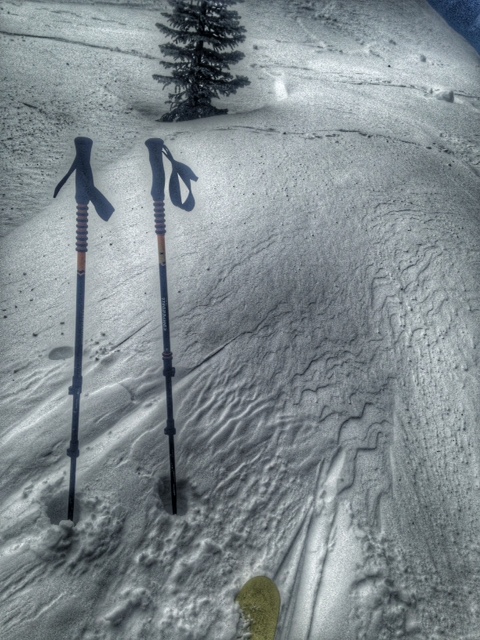
Blustery north winds, scattered clouds, and occasional snow showers kept things firm throughout the forecast area yesterday. Folks who went on a ski tour up at Castle Lake reported scoured, firm snow conditions with "dust on crust" in some areas. Small wind deposits of up to 6 inches in depth on the leeward side of trees, rocks, and ridge tops were also noted. The snow did not soften up at any point, and no recent avalanche activity was witnessed. There is a slight chance of small wind slab release potential in isolated NW-W-SW-S-SE-E facing wind loaded areas, but it is unlikely that enough snow would be entrained to be a hazard. The lake itself is still frozen solid with only the far northwest corner near the rock buttress showing liquid water.
For today, most concern will be for loose wet snow instabilities such as roller balls, pinwheels, and point release loose wet slides on southerly facing aspects on slopes 37 degrees and steeper. Continued moderate to strong northerly winds may limit the distribution of loose wet instabilities, but caution should still be taken around steep, southerly aspects today. The avalanche danger for loose wet avalanches will increase tomorrow, and the following days as temperatures increase and the sun shines. There may be potential for the developement of small wind slabs near and above treeline. Look for them on the leeward aspects noted above.
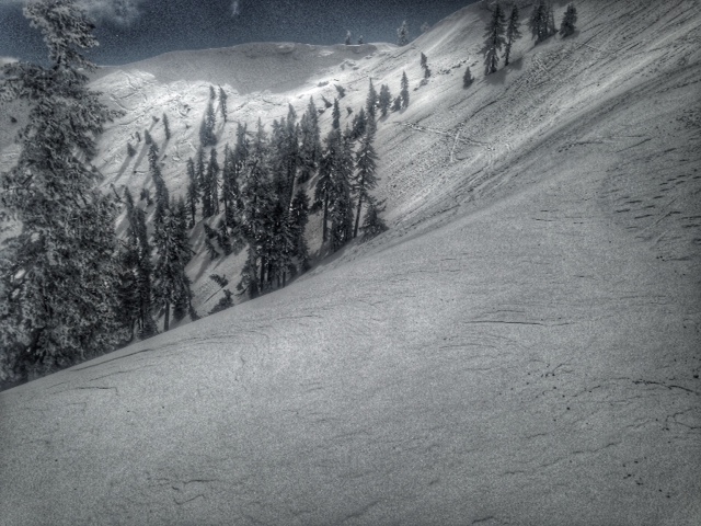
The wind affected snow surface above Castle Lake and near the top of Middle Peak 3/28/2016:
A note for all climbers and skiers heading up onto the upper mountain: Rime ice has formed on most rock outcroppings and is currently very thick. As warm days ensue, rime ice will flake off and fall down onto the slopes below. Rime ice chunks can be very large and very hard, enough to potentially kill you or cause serious injury. Beware of this hazard. Keep your eyes up slope as you climb and move laterally to avoid falling chunks of ice. If continuous ice fall is encountered turn around and descend to climb another day!
-----------------------------------------------------------------------------------------------------------------------------------------------------------
LOCAL AREA ROAD, NORDIC, AND SNOWMOBILE PARK STATUS:
The Sand Flat cross country ski trails are in good shape and ready for your cross country skis and snow shoes. These are backcountry routes marked with blue diamonds on trees. Trails are not groomed. Snow shoers, please blaze a parallel trail to cross country skiers staying out of the skin track. These trails can be accessed via the Everett Memorial Highway. Thank you, and enjoy!
The Mt. Shasta Nordic Center is open! These beautiful, groomed trails can be accessed via the Ski Park Highway. http://www.mtshastanordic.org
The Pilgrim Creek & Deer Mountain Snowmobile Parks are open! Trails have not been groomed in the past week and a half due to constant deep snow fall. Head to our "Education" tab on our website and find the snowmobile section for trail information, grooming status, and other sledder resources.
The Castle Lake Road is OPEN. The Everett Memorial Highway is OPEN. The Castle Lake and Everett Hwy are plowed year round to the trailheads. The roads are not always first priority, so your dawn patrol powder mission might be ceased if the plow has not made it up yet. Siskiyou County does a great job keeping the roads clear and be respectful of the plow drivers if you encounter them. If you get to Bunny Flat before or during when the plow is there, please park on the uphill, LEFT side of the parking lot as you drive in. This is uphill and lookers right of the bathrooms. Thank You!
The Five Red Flags of Avalanche Danger any time of year include: 1) Recent/current avalanche activity 2) Whumphing sounds or shooting cracks 3) Recent/current heavy snowfall 4) Strong winds transporting snow 5) Rapid warming or rain on snow.
Weather and Current Conditions
Weather Summary
Good Morning! In Mt Shasta City at 0500, we have a current temperature of 35 F, three degrees warmer than yesterday at this time. Skies are partly cloudy with light to moderate NNW wind.
On Mt Shasta (South Side) in the last 24 hours...
Old Ski Bowl - 7,600 feet, the current temperature is 20 degrees F. Snow on the ground totals 153 inches with a trace of new snow and 1 inch of settlement. Temperatures have ranged from 14 F to 29 F.
Gray Butte - 8,000 feet, the current temperature is 18 degrees F. Temperatures have ranged from 13 F to 27 F. Wind speeds will not be available for Gray Butte. The anemometer was taken down due to the need for repairs. Thank you for your understanding.
Mt Eddy Range (West side of Interstate-5)...
Castle Lake - 5,600 feet, the current temperature is 22 degrees F. Temperatures have ranged from 19 F to 32 F. Snow on the ground totals 73 inches with a trace of new snow and no settlement.
Mt Eddy - 6,500 feet, the current temperature is 20 degrees F. Temperatures have ranged from 16 F to 27 F. Snow on the ground measures 86 inches with no new snow and little settlement. Winds have been southeasterly in nature with an average of 4 mph, and a maximum gust of 17 mph, SSE.
Always check the weather before you attempt to climb Mt Shasta. Further, monitor the weather as you climb. Becoming caught on the mountain in any type of weather can compromise life and limb. Be prepared.
| 0600 temperature: | 23 |
| Max. temperature in the last 24 hours: | 32 |
| Average wind direction during the last 24 hours: | N/A |
| Average wind speed during the last 24 hours: | N/A mi/hr |
| Maximum wind gust in the last 24 hours: | N/A mi/hr |
| New snowfall in the last 24 hours: | 0 inches |
| Total snow depth: | 99 inches |
Two Day Mountain Weather Forecast
Produced in partnership with the Medford NWS
| For 7000 ft to 9000 ft | |||
|---|---|---|---|
|
Tuesday (4 a.m. to 10 p.m.) |
Tuesday Night (10 p.m. to 4 a.m.) |
Wednesday (4 a.m. to 10 p.m.) |
|
| Weather | Partly sunny with a 20% chance of some isolated snow showers. Breezy | Partly cloudy and bluster. | Sunny |
| Temperature (°F) | 41 | 29 | 49 |
| Wind (mi/hr) | North 15-25 mph | North 15-25 mph | Northeast 10-15 mph |
| Precipitation SWE / Snowfall (in) | / 0 | / 0 | / 0 |
| For 9000 ft to 11000 ft | |||
| Tuesday | Tuesday Night | Wednesday | |
| Weather | Partly sunny with a 20% chance of some isolated snow showers. Windy with wind chill values as low as -16 | Partly cloudy and windy. Wind chill values as low as -7 | Sunny and windy. |
| Temperature (°F) | 14 | 14 | 26 |
| Wind (mi/hr) | Northeast 40-45 mph with occasional higher gusts | Northeast 0 | Northeast 20-25 mph |
| Precipitation SWE / Snowfall (in) | / 0 | / 0 | / 0 |

