

You are here
Avalanche Advisory for 2018-02-05 06:40
- EXPIRED ON February 6, 2018 @ 6:40 amPublished on February 5, 2018 @ 6:40 am
- Issued by Andrew Kiefer - Mt Shasta Avalanche Center
Bottom Line
The avalanche danger is LOW for all elevations and aspects throughout the forecast area. Avalanches are unlikely and NORMAL CAUTION is advised. Shallow snowpack hazards exist. Watch for falling rime ice in upper elevation terrain on Mount Shasta.


Avalanche Problem 1: Normal Caution
-
Character ?

-
Aspect/Elevation ?
-
Likelihood ?CertainVery LikelyLikelyPossible
 Unlikely
 -
Size ?HistoricVery LargeLargeSmall

NORMAL CAUTION means:
- Always watch for isolated slabs.
- Ski and ride one at a time in avalanche terrain.
- Don't regroup in run out zones.
- Basic avalanche rescue skills are essential in avalanche terrain.
Isolated slabs are generally related to wind and terrain. Look for places where small areas of drifting have occurred and firm layers of surface snow overlie softer layers. Often this will occur on the lee side of ridges, in terrain depressions, on convex terrain features and in the lee of isolated bands of trees.
Forecast Discussion
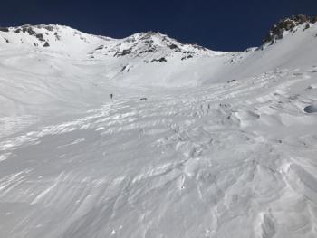
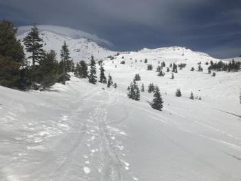
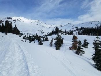
Sunshine and well above average temperatures are making for spring-like conditions on Mount Shasta. Corn snow can be found on southerly slopes by mid-day, and supportable snow surfaces make for good cramponing on the upper mountain. Winds have been strong and gusty lately, and have turned back many climbers attempting south-side routes. Icefall remains a concern. Continue to exercise normal caution. There is always some degree of risk, and even traveling on a LOW danger day is not a 100% guarantee of safety.
Recent Observations
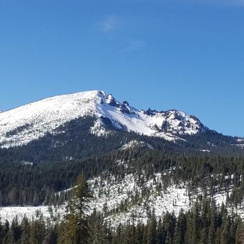
For well over a week, temperatures have remained above freezing at the Old Ski Bowl and Grey Butte weather stations. Snowpack stability has been very good overall. During the recent warm up, two small wet-loose avalanches were observed on steep southeast facing slopes above treeline. Snow cover is still good near and above treeline, while below treeline, the warm temperatures are melting snow quickly.
Yesterday, strong northerly winds blew above 9,000 ft for most of the day. Snow surfaces were variable and supportable crusts, wind textured features and firm snow were all found. No active rime icefall was observed in Avalanche Gulch. The corn skiing was good on southerly slopes by mid-day.
Weather and Current Conditions
Weather Summary
The dry and clear weather will continue. Northerly winds will be strong and gusty in the mountains with increasing speeds throughout the day. High temperatures will reach 50 degrees. The unseasonably warm weather will continue with highs in the mid 60s expected on Wednesday and Thursday. Weather models project extreme dryness for the region during the month of February.
The infamous precipitation “donut hole” will most likely persist over California for the foreseeable future (weatherwest.com and tropicaltidbits.com):

24 Hour Weather Station Data @ 6:00 AM
| Weather Station | Temp (°F) | Wind (mi/hr) | Snow (in) | Comments | ||||||||
|---|---|---|---|---|---|---|---|---|---|---|---|---|
| Cur | Min | Max | Avg | Avg | Max Gust | Dir | Depth | New | Water Equivalent | Settlement | ||
| Mt. Shasta City (3540 ft) | 45 | 35 | 63 | 49 | 4 | WNW | ||||||
| Sand Flat (6750 ft) | 40 | 31 | 51 | 42 | 21 | 0 | 0 | 0 | ||||
| Ski Bowl (7600 ft) | 40.5 | 38.5 | 49 | 44.5 | 41 | 0 | 0 | 0 | ||||
| Gray Butte (8000 ft) | 41.5 | 39 | 48.5 | 43.5 | 9 | 49 | NNW | |||||
| Castle Lake (5870 ft) | 42 | 41 | 54 | 45 | 8 | 0 | 1 | |||||
| Mount Eddy (6509 ft) | 42.5 | 39.5 | 50.5 | 45.5 | 2 | 9 | SSE | 21 | 0 | 1 | ||
| Ash Creek Bowl (7250 ft) | station down | |||||||||||
| Ash Creek Ridge (7895 ft) | station down |
Two Day Mountain Weather Forecast
Produced in partnership with the Medford NWS
| For 7000 ft to 9000 ft | |||
|---|---|---|---|
|
Monday (4 a.m. to 10 p.m.) |
Monday Night (10 p.m. to 4 a.m.) |
Tuesday (4 a.m. to 10 p.m.) |
|
| Weather | Sunny and breezy | Mostly clear and blustery | Sunny |
| Temperature (°F) | 47 | 30 | 46 |
| Wind (mi/hr) | North/Northwest 10-15 mi/hr | North/Northwest 10-15 mi/hr | North/Northwest 10-15 mi/hr |
| Precipitation SWE / Snowfall (in) | / 0 | / 0 | / 0 |
| For 9000 ft to 11000 ft | |||
| Monday | Monday Night | Tuesday | |
| Weather | Sunny and windy | Mostly clear and windy | Sunny and windy |
| Temperature (°F) | 29 | 27 | 32 |
| Wind (mi/hr) | Northwest 25-35 mi/hr | North 0 | North 30-40 mi/hr |
| Precipitation SWE / Snowfall (in) | / 0 | / 0 | / 0 |
Season Precipitation for Mount Shasta City
| Period | Measured (in) | Normal (in) | Percent of Normal (%) |
|---|---|---|---|
| From Oct 1, 2023 (the wet season) | 10.11 | 22.75 | 44 |
| Month to Date (since Apr 1, 2024) | 0.00 | 0.48 | 0 |
| Year to Date (since Jan 1, 2024) | 4.28 | 7.54 | 57 |

