

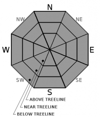
You are here
Avalanche Advisory for 2018-02-09 05:55
- EXPIRED ON February 10, 2018 @ 5:55 amPublished on February 9, 2018 @ 5:55 am
- Issued by Nick Meyers - Shasta-Trinity National Forest
Bottom Line
Avalanche danger is LOW. Avalanches are unlikely and NORMAL CAUTION is advised. Shallow snowpack hazards exist. Beware of falling rime ice above 9500 ft.


Avalanche Problem 1: Normal Caution
-
Character ?

-
Aspect/Elevation ?
-
Likelihood ?CertainVery LikelyLikelyPossible
 Unlikely
 -
Size ?HistoricVery LargeLargeSmall

NORMAL CAUTION means:
- Watch for isolated slabs.
- Ski and ride one at a time in avalanche terrain.
- Don't regroup in run out zones.
- Basic avalanche rescue skills are essential in avalanche terrain.
Isolated slabs are related to wind and terrain. Look for places where small areas of drifting have occurred and firm layers of surface snow overlie softer layers. This will occur on the lee side of ridges, in terrain depressions, on convex terrain features, and in the lee of isolated bands of trees
Forecast Discussion
Falling rime ice is a concern above 9500 ft. Firm snow surfaces exist. Wear a helmet and bring an ice axe, crampons, and the knowledge to use them if traveling on steep terrain.
Recent Observations
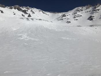
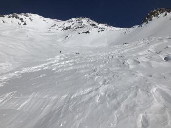
A wide array of snow surface conditions were observed during a jaunt up to 11,000 feet in Avalanche Gulch yesterday (see observation for photos). Favorable corn skiing conditions can be found in select swaths of terrain above treeline on E-SE-S and some SW facing slopes. Overall, expect to encounter the full nine yards... rough, wind eroded features; smooth, glazed and icy snow; softer melt-freeze surfaces and various sastrugi formations. Falling rime ice was not observed but many rocks still have chunks of rime stuck to them. Winds were light out of the southeast with highs near 50 deg F.
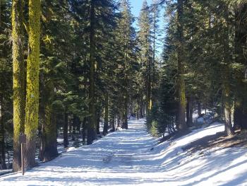
Upper Sand Flat cross-country ski trails are still usable.
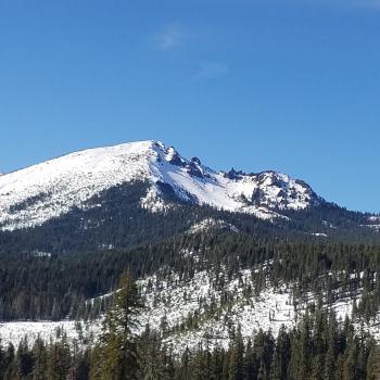
All other areas within the forecast area, aside from Mount Shasta itself, are not in play due to lack of snow. Below treeline, snow is melting fast and shallow snowpack hazards are an increasing concern.
Weather and Current Conditions
Weather Summary
Through Saturday night, high pressure remains and will bring dry weather and near normal temperatures. A system will arrive Sunday morning from the north, pushing light precipitation and cooler air into the region. Overall, this system is not expected to bring significant rainfall and/or snow to the area.
Expect windy conditions in exposed areas above treeline on Mount Shasta today.
24 Hour Weather Station Data @ 4:00 AM
| Weather Station | Temp (°F) | Wind (mi/hr) | Snow (in) | Comments | ||||||||
|---|---|---|---|---|---|---|---|---|---|---|---|---|
| Cur | Min | Max | Avg | Avg | Max Gust | Dir | Depth | New | Water Equivalent | Settlement | ||
| Mt. Shasta City (3540 ft) | 35 | 34 | 68 | 48.5 | 4 | N | ||||||
| Sand Flat (6750 ft) | 41 | 36 | 54 | 45 | 19 | 0 | 0 | 1 | ||||
| Ski Bowl (7600 ft) | 42.5 | 42.5 | 53 | 47.5 | 39 | 0 | 0 | 1.5 | ||||
| Gray Butte (8000 ft) | 42.5 | 42.5 | 53 | 47.5 | 8 | 43 | NNW | |||||
| Castle Lake (5870 ft) | 44.5 | 44.5 | 54 | 48.5 | 8 | 0 | .5 | |||||
| Mount Eddy (6509 ft) | 44 | 42.5 | 52.5 | 46.5 | 2 | 12 | SSE | 20 | 0 | .5 | ||
| Ash Creek Bowl (7250 ft) | 0 | 0 | 0 | 0 | 0 | 0 | station down | |||||
| Ash Creek Ridge (7895 ft) | 0 | 0 | 0 | 0 | 0 | 0 | station down |
Two Day Mountain Weather Forecast
Produced in partnership with the Medford NWS
| For 7000 ft to 9000 ft | |||
|---|---|---|---|
|
Friday (4 a.m. to 10 p.m.) |
Friday Night (10 p.m. to 4 a.m.) |
Saturday (4 a.m. to 10 p.m.) |
|
| Weather | Mostly sunny | Clear and breezy | Sunny and breezy |
| Temperature (°F) | 49 | 26 | 39 |
| Wind (mi/hr) | NW 10-15 mi/hr | NW 10-15 mi/hr | N 10-15 mi/hr |
| Precipitation SWE / Snowfall (in) | / 0 | / 0 | / 0 |
| For 9000 ft to 11000 ft | |||
| Friday | Friday Night | Saturday | |
| Weather | Sunny and windy | Clear and windy. | Sunny and windy |
| Temperature (°F) | 32 | 22 | 28 |
| Wind (mi/hr) | NW 25-35 mi/hr | NW 0 | NW 30-40 mi/hr |
| Precipitation SWE / Snowfall (in) | / 0 | / 0 | / 0 |
Season Precipitation for Mount Shasta City
| Period | Measured (in) | Normal (in) | Percent of Normal (%) |
|---|---|---|---|
| From Oct 1, 2023 (the wet season) | 10.11 | 24.22 | 42 |
| Month to Date (since Apr 1, 2024) | 0.00 | 1.95 | 0 |
| Year to Date (since Jan 1, 2024) | 4.28 | 9.01 | 48 |

