

You are here
Avalanche Advisory for 2018-03-26 06:38
- EXPIRED ON March 27, 2018 @ 6:38 amPublished on March 26, 2018 @ 6:38 am
- Issued by Andrew Kiefer - Mt Shasta Avalanche Center
Bottom Line
Strong north winds are expected to transport snow and load leeward aspects above treeline over the next 24 hours. Human triggered wind slab avalanches remain possible. Intense solar radiation may also weaken snow surfaces and cause minor wet loose avalanche activity.


Avalanche Problem 1: Wind Slab
-
Character ?

-
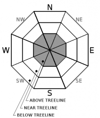
Aspect/Elevation ?
-
Likelihood ?CertainVery LikelyLikelyPossible
 Unlikely
 -
Size ?HistoricVery LargeLargeSmall

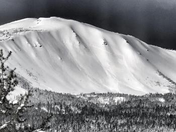
Even though the recent storm has ended, wind slabs remain a concern in leeward terrain above treeline. Today, watch for northerly winds to blow snow and create fresh winds slabs. Of most concern are slopes 35 degrees and steeper above treeline facing south and east. In these specific areas, wind slabs could be several feet thick, and could be triggered by skiers and riders. Look for blowing snow, wind drifts, shooting cracks, wind eroded snow surfaces and hollow sounding snow as signs of the wind slab problem.
Forecast Discussion
The change in wind direction today may create complex loading patterns. In addition to leeward aspects, be sure to watch for wind slabs on cross-loaded features like gullies, moraines and convex rollovers. Carefully evaluate slopes 35 degrees and steeper above treeline.
Strong solar radiation will continue to impact snow surfaces today. Expect minor wet loose activity including roller balls and pinwheels on steep southerly slopes near and below treeline.
Recent Observations
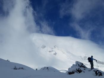
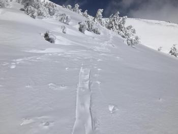
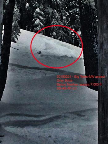
Skies cleared as the 5-day storm came to an end yesterday. No avalanches or concerning signs of instability were observed on the south side of Mount Shasta between 7,000-10,000 ft or in the Ash Creek Butte area. Evidence of wind loading was easy to find above treeline. Westerly winds were visibly transporting snow onto leeward aspects. Drifts of snow 2-4 ft deep were encountered as well as small wind lips and cornices along ridgelines. No wind slabs were seen, but plenty of snow remains available for transport. Intense solar radiation yesterday caused minor roller balls and formed a thin crust on steep south facing aspects near and below treeline. Temperatures reached 47 degrees at the Old Ski Bowl weather station in the afternoon.
Weather and Current Conditions
Weather Summary
A ridge of high pressure over northern California will bring dry and warm conditions through the end of the workweek. Today will be sunny with highs in the lower 40s at 7,000 ft. North winds are expected above treeline with average speeds of 30-40 mph and gusts to 50 mph.
24 Hour Weather Station Data @ 3:00 AM
| Weather Station | Temp (°F) | Wind (mi/hr) | Snow (in) | Comments | ||||||||
|---|---|---|---|---|---|---|---|---|---|---|---|---|
| Cur | Min | Max | Avg | Avg | Max Gust | Dir | Depth | New | Water Equivalent | Settlement | ||
| Mt. Shasta City (3540 ft) | 28 | 27 | 43 | 36 | 1 | W | ||||||
| Sand Flat (6750 ft) | station down | |||||||||||
| Ski Bowl (7600 ft) | 13 | 12.5 | 47.5 | 22.5 | 92 | 0 | 0.01 | 3 | ||||
| Gray Butte (8000 ft) | 15 | 12 | 30.5 | 18.5 | 7 | 28 | WNW | |||||
| Castle Lake (5870 ft) | station down | |||||||||||
| Mount Eddy (6509 ft) | 17 | 14.5 | 26 | 20.5 | 1 | 8 | ENE | 52 | 1 | 4 | ||
| Ash Creek Bowl (7250 ft) | station down | |||||||||||
| Ash Creek Ridge (7895 ft) | station down |
Two Day Mountain Weather Forecast
Produced in partnership with the Medford NWS
| For 7000 ft to 9000 ft | |||
|---|---|---|---|
|
Monday (4 a.m. to 10 p.m.) |
Monday Night (10 p.m. to 4 a.m.) |
Tuesday (4 a.m. to 10 p.m.) |
|
| Weather | Mostly sunny | Partly cloudy | Mostly sunny |
| Temperature (°F) | 36 | 27 | 46 |
| Wind (mi/hr) | N 5-10 mi/hr | N 5-10 mi/hr | N 5-10 mi/hr |
| Precipitation SWE / Snowfall (in) | / 0 | / 0 | / 0 |
| For 9000 ft to 11000 ft | |||
| Monday | Monday Night | Tuesday | |
| Weather | Mostly sunny and windy | Partly cloudy and windy | Mostly sunny and windy |
| Temperature (°F) | 22 | 22 | 31 |
| Wind (mi/hr) | N 30-40 mi/hr | N 0 | N 20-30 mi/hr |
| Precipitation SWE / Snowfall (in) | / 0 | / 0 | / 0 |
Season Precipitation for Mount Shasta City
| Period | Measured (in) | Normal (in) | Percent of Normal (%) |
|---|---|---|---|
| From Oct 1, 2023 (the wet season) | 15.95 | 34.65 | 46 |
| Month to Date (since Apr 1, 2024) | 5.06 | 5.15 | 98 |
| Year to Date (since Jan 1, 2024) | 10.12 | 19.44 | 52 |

