

You are here
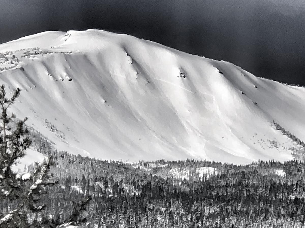
Out of area avalanche: Mount Bailey
Location Name:
Mount BaileyRegion:
Outside of the Forecast AreaDate and time of avalanche (best estimate if unknown):
Sat, 03/24/2018 - 4:00pmObservation made by:
PublicRed Flags:
Recent avalanche activity
Recent loading by new snow, wind, or rain
Obvious avalanche path
Location Map
96067
Mount Shasta
, CA
United States
43° 9' 43.398" N, 122° 12' 21.6324" W
See map: Google Maps
California US
Avalanche Observations
Details
Characteristics
Avalanche Type:
SlabTrigger type:
NaturalSlope:
38degreesElevation:
8 000ft.Terrain:
Above TreelineWeak Layer:
Storm SnowBed Surface:
UnknownNumber of people caught:
0Number of partial burials:
0Number of full burials:
0Weather Observations
Details
Winter storm recently dumped 1-2 feet of fresh snow in a 24 hour period.
Statistics
Cloud Cover:
25% of the sky covered by cloudsBlowing Snow:
YesPrecipitation:
NoneAccumulation rate:
NoneAir temperature:
Below FreezingAir temperature trend:
StaticWind Speed:
CalmWind Direction:
Southwest

Not much is known about this fairly large natural storm slab avalanche that is estimated to have occurred early this morning. Nobody was caught. Crown estimated 1-2 feet deep.