You are here
Avalanche Advisory for 2018-02-08 05:51
- EXPIRED ON February 9, 2018 @ 5:51 amPublished on February 8, 2018 @ 5:51 am
- Issued by Nick Meyers - Shasta-Trinity National Forest
Bottom Line
Avalanche danger is LOW. Avalanches are unlikely and NORMAL CAUTION is advised. Shallow snowpack hazards exist. Beware of falling rime ice above 9500 ft.
Avalanche Problem 1: Normal Caution
-
Character ?

-
Aspect/Elevation ?

-
Likelihood ?CertainVery LikelyLikelyPossible
 Unlikely
 -
Size ?HistoricVery LargeLargeSmall

NORMAL CAUTION means:
- Watch for isolated slabs.
- Ski and ride one at a time in avalanche terrain.
- Don't regroup in run out zones.
- Basic avalanche rescue skills are essential in avalanche terrain.
Isolated slabs are related to wind and terrain. Look for places where small areas of drifting have occurred and firm layers of surface snow overlie softer layers. This will occur on the lee side of ridges, in terrain depressions, on convex terrain features, and in the lee of isolated bands of trees
Forecast Discussion
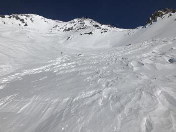
Falling rime ice is a concern above 9500 ft. Firm snow surfaces exist. Wear a helmet and bring an ice axe, crampons, and the knowledge to use them if traveling on steep terrain. Northerly winds will increase on the mountain over the next 24 hours.
Recent Observations
- A temperature inversion this morning has temps in the high 40's deg F at 8,000 feet and 33 deg F in Mount Shasta City.
- Light, easterly winds over the past 24 hours
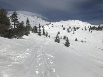
- Skiers reporting favorable conditions above 8,000 feet. Below, the snowpack is thin and sparse. Use caution for shallow snowpack hazards.
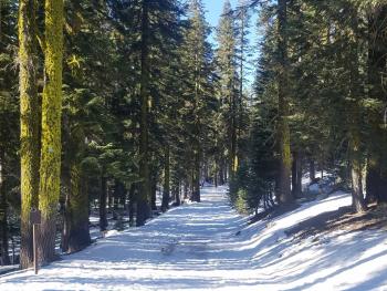
- The Upper Sand Flat cross country trails hosts a usable snowpack.
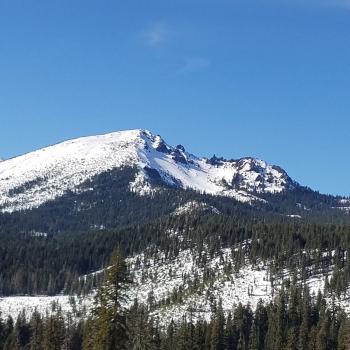
- All other areas within the forecast area, aside from Mount Shasta itself, are not in play due to lack of snow.
Weather and Current Conditions
Weather Summary
The high pressure ridge remains locked in place. A more northerly flow over the next 24 hours will bring windy conditions to the mountain and dry, cold air. The main effect from this will be colder night time temperatures. Daytime temps will be close to seasonal normals. Dry conditions will persist for another week.
24 Hour Weather Station Data @ 5:00 AM
| Weather Station | Temp (°F) | Wind (mi/hr) | Snow (in) | Comments | ||||||||
|---|---|---|---|---|---|---|---|---|---|---|---|---|
| Cur | Min | Max | Avg | Avg | Max Gust | Dir | Depth | New | Water Equivalent | Settlement | ||
| Mt. Shasta City (3540 ft) | 33 | 32 | 57 | 42.5 | 4 | N | ||||||
| Sand Flat (6750 ft) | 36 | 30 | 51 | 38 | 20 | 0 | 0 | 0 | ||||
| Ski Bowl (7600 ft) | 47 | 37.5 | 51.5 | 45.5 | 39 | 0 | 0 | 1 | ||||
| Gray Butte (8000 ft) | 48.5 | 39 | 48.5 | 45.5 | 7 | 25 | E | |||||
| Castle Lake (5870 ft) | 46.5 | 38 | 51 | 47 | 8.5 | 0 | 0 | |||||
| Mount Eddy (6509 ft) | 45.5 | 36 | 51 | 43.5 | 2 | 5 | WSW | 19.5 | 0 | 0 | ||
| Ash Creek Bowl (7250 ft) | 0 | 0 | 0 | 0 | 0 | 0 | station down | |||||
| Ash Creek Ridge (7895 ft) | 0 | 0 | 0 | 0 | 0 | 0 | station down |
Two Day Mountain Weather Forecast
Produced in partnership with the Medford NWS
| For 7000 ft to 9000 ft | |||
|---|---|---|---|
|
Thursday (4 a.m. to 10 p.m.) |
Thursday Night (10 p.m. to 4 a.m.) |
Friday (4 a.m. to 10 p.m.) |
|
| Weather | Sunny. | Clear. | Sunny, breezy |
| Temperature (°F) | 57 | 34 | 48 |
| Wind (mi/hr) | NW 5-10 mi/hr | NW 5-10 mi/hr | NW 10-15 mi/hr |
| Precipitation SWE / Snowfall (in) | / 0 | / 0 | / 0 |
| For 9000 ft to 11000 ft | |||
| Thursday | Thursday Night | Friday | |
| Weather | Sunny, increasing winds | Clear, windy. | Sunny and windy |
| Temperature (°F) | 34 | 31 | 32 |
| Wind (mi/hr) | NW 10-20 mi/hr | NW 0 | NW 30-40 mi/hr |
| Precipitation SWE / Snowfall (in) | / 0 | / 0 | / 0 |
Season Precipitation for Mount Shasta City
| Period | Measured (in) | Normal (in) | Percent of Normal (%) |
|---|---|---|---|
| From Oct 1, 2024 (the wet season) | 10.11 | 23.97 | 42 |
| Month to Date (since Apr 1, 2025) | 0.00 | 1.70 | 0 |
| Year to Date (since Jan 1, 2025) | 4.28 | 8.76 | 49 |


