You are here
Avalanche Advisory for 2018-02-28 06:18
- EXPIRED ON March 1, 2018 @ 6:18 amPublished on February 28, 2018 @ 6:18 am
- Issued by Aaron Beverly - Mount Shasta Avalanche Center
Bottom Line
Avalanche danger will be LOW today at all elevations but will rise to MODERATE tonight as a winter storm begins to impact the area with high winds and significant snowfall. Recent wind slabs may be found on isolated terrain with S/SE aspects. Ridgelines, start zones, and the tops of moraines are icy and exposed. Tonight new wind slabs will begin to form on NW/N/NE aspects near and above treeline.
Avalanche Problem 1: Wind Slab
-
Character ?

-
Aspect/Elevation ?

-
Likelihood ?CertainVery LikelyLikelyPossible
 Unlikely
 -
Size ?HistoricVery LargeLargeSmall

Wind slab concerns from prior storms have diminished. You may find them in isolated areas on S/SE aspects near and above treeline, but these will be small and stubborn to trigger and hard to find in start zones. Today expect LOW avalanche danger.
With the incoming storm this afternoon and 3-5 inches of snow expected by 10 p.m., new wind slabs, 10-15 inches thick, will begin to form tonight on NW/N/NE aspects above 8000 ft. With many icy snow surfaces exposed, these slabs could be touchy to human trigger. Avalanche danger will rise to MODERATE tonight.
Forecast Discussion
Avalanche forecasts are about to get interesting again. Avalanche danger will remain LOW most of the day today, but will rise to MODERATE tonight as the incoming storm begins in earnest. By tomorrow morning, over 10 inches of new snow is expected and CONSIDERABLE avalanche danger may exist.
If you are brave enough to be out in the mountains tonight, hold on and monitor changing conditions. Be prepared for high winds and low wind chills. Remember the 5 red flags for avalanche danger:
- Recent avalanche activity
- Shooting cracks or whoomphing
- Significant snowfall in 24 hours
- Strong winds
- Temperature rise
Recent Observations
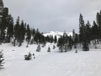
Dry low density snow seen near and above treeline on Monday has been stripped away by N/NW winds and deposited on S/SE aspects and in gullies and terrain depressions between 7500 and 10,000 ft. Most start zones are scoured to icy surfaces or rock as are the tops of moraines and ridges.
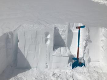
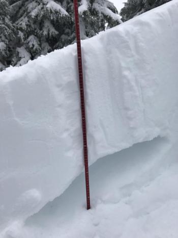
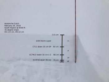
Wind slabs in leeward areas with a mix of new and recent windloading were stubborn to trigger. New slabs atop the old icy snow surface were easy to trigger with hand tests, but areas where this configuration was found were small and few.
High-marking snowmobile traffic yielded no avalanches.
Overall the wind slab problem was isolated and snowpack stability was good.
See yesterday's observation for more details.
Weather and Current Conditions
Weather Summary
A winter storm warning is in effect from Wednesday afternoon through 1 p.m. Thursday. This will be the most significant winter storm for Mount Shasta so far this winter season.
The effects of this storm will begin in earnest after 4 p.m. today and will continue through Saturday. Altogether, up to 2.28 inches of water could fall in the forecast area above 3000 ft. This could translate to 22 to 44 inches of snow from mid to high elevations. Generous spot forecasts are calling for well over 4 ft of snow by Saturday.
24 Hour Weather Station Data @ 5:00 AM
| Weather Station | Temp (°F) | Wind (mi/hr) | Snow (in) | Comments | ||||||||
|---|---|---|---|---|---|---|---|---|---|---|---|---|
| Cur | Min | Max | Avg | Avg | Max Gust | Dir | Depth | New | Water Equivalent | Settlement | ||
| Mt. Shasta City (3540 ft) | 28 | 21 | 40 | 29.5 | 3 | |||||||
| Sand Flat (6750 ft) | station down | |||||||||||
| Ski Bowl (7600 ft) | 19 | 12.5 | 28.5 | 22.5 | 43.5 | 0 | 0 | .5 | ||||
| Gray Butte (8000 ft) | 21 | 16 | 27 | 22 | 10 | 37 | SE | |||||
| Castle Lake (5870 ft) | 25.5 | 12 | 29.5 | 23 | 10.5 | 0 | .5 | |||||
| Mount Eddy (6509 ft) | 24 | 11.5 | 27.5 | 22.5 | 2 | 13 | WSW | 30 | 0 | 2.5 | ||
| Ash Creek Bowl (7250 ft) | station down | |||||||||||
| Ash Creek Ridge (7895 ft) | station down |
Two Day Mountain Weather Forecast
Produced in partnership with the Medford NWS
| For 7000 ft to 9000 ft | |||
|---|---|---|---|
|
Wednesday (4 a.m. to 10 p.m.) |
Wednesday Night (10 p.m. to 4 a.m.) |
Thursday (4 a.m. to 10 p.m.) |
|
| Weather | Snow, mainly after 10am. Chance of precipitation is 80%. | Snow. The snow could be heavy at times. Windy. Chance of precipitation is 100% | Snow showers. The snow could be heavy at times. Breezy. Chance of precipitation is 100%. |
| Temperature (°F) | 30 | 26 | 28 |
| Wind (mi/hr) | S 10-15 mi/hr | S 20-25 mi/hr | S 20 mi/hr |
| Precipitation SWE / Snowfall (in) | / 1-3 | / 8-14 | / 8-14 |
| For 9000 ft to 11000 ft | |||
| Wednesday | Wednesday Night | Thursday | |
| Weather | Snow, mainly after 10am. Windy. Wind chill values as low as -13. Chance of precipitation is 80%. | Snow. The snow could be heavy at times. Windy. Wind chill values as low as -15. Chance of precipitation is 100%. | Snow showers. The snow could be heavy at times. Windy. Wind chill values as low as -30. Chance of precipitation is 100%. |
| Temperature (°F) | 17 | 15 | 15 |
| Wind (mi/hr) | W 30-35 mi/hr | SW 1-3 | S 50-55 mi/hr |
| Precipitation SWE / Snowfall (in) | / 1-3 | / 11-17 | / 11-17 |
Season Precipitation for Mount Shasta City
| Period | Measured (in) | Normal (in) | Percent of Normal (%) |
|---|---|---|---|
| From Oct 1, 2024 (the wet season) | 10.49 | 29.23 | 36 |
| Month to Date (since Dec 1, 2024) | 0.38 | 6.96 | 5 |
| Year to Date (since Jan 1, 2024) | 4.66 | 14.02 | 33 |


