You are here
Avalanche Advisory for 2018-03-04 07:00
- EXPIRED ON March 5, 2018 @ 7:00 amPublished on March 4, 2018 @ 7:00 am
- Issued by Andrew Kiefer - Mt Shasta Avalanche Center
Bottom Line
Wind slabs several feet thick have recently formed on N-NE-E-SE-S aspects near and above treeline. Storm slabs remain a concern as the snowpack adjusts to the weight of the new snow. CONSIDERABLE avalanche danger exists above treeline while the danger is MODERATE near and below treeline.
Avalanche Problem 1: Wind Slab
-
Character ?

-
Aspect/Elevation ?

-
Likelihood ?CertainVery LikelyLikelyPossible
 Unlikely
 -
Size ?HistoricVery LargeLargeSmall

Wind loading during the storm created wind slabs 3-6 feet thick. Fresh wind slabs may form today with continued westerly winds. Wind slabs often grow in size and distribution even after a storm ends, and wind slabs are expected to remain a concern in the coming days. On wind loaded slopes 35 degrees and steeper above treeline, human triggered avalanches are likely and natural avalanches are possible. Avoid the wind slab problem by sticking to sheltered or wind-scoured areas. Watch for hollow sounding snow, pillows of loaded snow, textured snow surfaces and small cornices/wind lips as evidence of recent wind loading.
Avalanche Problem 2: Storm Slab
-
Character ?

-
Aspect/Elevation ?

-
Likelihood ?CertainVery LikelyLikelyPossible
 Unlikely
 -
Size ?HistoricVery LargeLargeSmall

No storm slab avalanches have been observed, but whumphing and unstable stability test results have occurred recently near and below treeline. Uncertainty exists regarding how well the new snow has bonded to the old snow surface now buried 2-3 feet deep. Dig down to assess this layer near and below treeline on all aspects, and stick to low angle terrain to avoid the storm slab problem.
Forecast Discussion
Our biggest storm of the year is coming to an end with 4-day storm totals ranging from 2-3 feet throughout the advisory area. Wind slabs remain the primary concern. With plenty of snow available for transport, fresh winds slabs will develop with continued westerly winds. Dangerous avalanche conditions exist in the backcountry and careful snowpack evaluation, cautious route finding and conservative decision-making are essential today.
Recent Observations
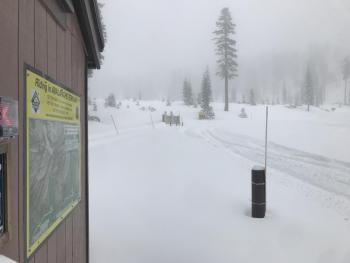
West/northwest winds have averaged 5-10 mph with gusts to 21 mph at 8,000 ft over the past 24 hours. We received the majority of our recent snow on Thursday and Friday, with only 1-2 inches accumulating during the tail end of the storm last night.
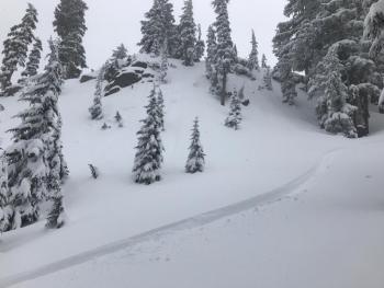
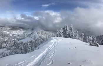
During a tour yesterday up Grey Butte from the Mount Shasta Ski Park, no recent avalanches were observed even as skies cleared to 12,000 ft on Mount Shasta. The most notable evidence of wind loading was in leeward terrain above 8,000 ft where pillows of loaded snow and “scalloped” snow surfaces were observed. Small and isolated cornices/wind lips have formed along ridgelines near treeline, but appear stubborn to trigger.
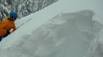
Observations yesterday found the layer of greatest concern in the snowpack to be the old/new snow interface, now buried 2-3 feet deep. Several whumphs were heard near and below treeline. Stability tests conducted in two separate pits on SW and NE aspects near treeline produced sudden collapse fractures and full propagation on this layer.
Weather and Current Conditions
Weather Summary
An upper level trough of low-pressure remains over the region bringing a slight chance for light snow showers today. Skies will be mostly cloudy this morning with gradual clearing this afternoon. Light southwest/west winds will continue with high temperatures in the teens and low 20s in the mountains. Conditions will dry out as a weak high-pressure system sets up over northern California during the next 24-hours. Tomorrow should bring sunny skies with increasing westerly winds.
24 Hour Weather Station Data @ 6:00 AM
| Weather Station | Temp (°F) | Wind (mi/hr) | Snow (in) | Comments | ||||||||
|---|---|---|---|---|---|---|---|---|---|---|---|---|
| Cur | Min | Max | Avg | Avg | Max Gust | Dir | Depth | New | Water Equivalent | Settlement | ||
| Mt. Shasta City (3540 ft) | 26 | 25 | 34 | 29.5 | 1 | N | ||||||
| Sand Flat (6750 ft) | station down | |||||||||||
| Ski Bowl (7600 ft) | 12 | 8.5 | 46 | 17.5 | 65 | .5 | 0.05 | 2 | ||||
| Gray Butte (8000 ft) | 10.5 | 9.5 | 24.5 | 14.5 | 8 | 18 | WNW | |||||
| Castle Lake (5870 ft) | 16 | 15.5 | 28.5 | 20.5 | 32.5 | 1 | 3 | |||||
| Mount Eddy (6509 ft) | 10 | 10 | 22.5 | 16 | 1 | 7 | WSW | 47.5 | 2 | 3 | ||
| Ash Creek Bowl (7250 ft) | station down | |||||||||||
| Ash Creek Ridge (7895 ft) | station down |
Two Day Mountain Weather Forecast
Produced in partnership with the Medford NWS
| For 7000 ft to 9000 ft | |||
|---|---|---|---|
|
Sunday (4 a.m. to 10 p.m.) |
Sunday Night (10 p.m. to 4 a.m.) |
Monday (4 a.m. to 10 p.m.) |
|
| Weather | A 20% of snow showers then partly sunny. | A 20% chance of snow showers before 10pm then mostly cloudy. | Mostly sunny |
| Temperature (°F) | 26 | 16 | 33 |
| Wind (mi/hr) | SW 0-5 mi/hr | SW 5-10 mi/hr | W 0-5 mi/hr |
| Precipitation SWE / Snowfall (in) | / 0-.5 | / 0-.5 | / 0 |
| For 9000 ft to 11000 ft | |||
| Sunday | Sunday Night | Monday | |
| Weather | A 20% of snow showers then partly sunny and cold. | A 20% chance of snow showers before 10pm then mostly cloudy. | Mostly sunny and windy |
| Temperature (°F) | 9 | 9 | 14 |
| Wind (mi/hr) | W 10-15 mi/hr | W 0-.5 | W/SW 15-25 mi/hr |
| Precipitation SWE / Snowfall (in) | / 0-.5 | / 0-.5 | / 0 |
Season Precipitation for Mount Shasta City
| Period | Measured (in) | Normal (in) | Percent of Normal (%) |
|---|---|---|---|
| From Oct 1, 2024 (the wet season) | 12.20 | 30.28 | 40 |
| Month to Date (since Apr 1, 2025) | 1.31 | 0.78 | 168 |
| Year to Date (since Jan 1, 2025) | 6.37 | 15.07 | 42 |


