You are here
Avalanche Advisory for 2018-03-05 07:01
- EXPIRED ON March 6, 2018 @ 7:01 amPublished on March 5, 2018 @ 7:01 am
- Issued by Andrew Kiefer - Mt Shasta Avalanche Center
Bottom Line
Human triggered wind slab avalanches are possible on S-SE-E-NE-N aspects near and above treeline. Increasing westerly winds may create fresh wind slabs in leeward terrain. MODERATE avalanche danger exists near and above treeline while the danger is LOW below treeline. A rapid warm up today may create the potential for wet loose avalanches on steep sun exposed slopes.
Avalanche Problem 1: Wind Slab
-
Character ?

-
Aspect/Elevation ?

-
Likelihood ?CertainVery LikelyLikelyPossible
 Unlikely
 -
Size ?HistoricVery LargeLargeSmall

Westerly winds over the next 48-hours may create fresh wind slabs near and above treeline on S-SE-E-NE-N aspects. Plenty of low-density snow from our recent storm is available for transport. Little evidence of wind loading has been observed during the storm. This could change rapidly today and tomorrow as westerly winds may increase to favorable speeds for transporting snow. Human triggered wind slab avalanches will be possible on leeward slopes and terrain features 35 degrees and steeper. Avoid the wind slab problem by sticking to sheltered or wind-scoured areas. Watch for hollow sounding snow, pillows of loaded snow, textured snow surfaces and small cornices/wind lips as evidence of recent wind loading.
Forecast Discussion
Our recent storm kicked off March on a very positive note with a dramatic return to winter. Today will bring blue skies and sunshine with plenty of fresh powder left over from the storm. The most critical factor influencing the avalanche danger today and tomorrow will be westerly winds. Fresh wind slabs may form in leeward terrain near and above treeline. Pay close attention to wind loading and don’t let the nice weather lure you into complacency. In addition, snow surfaces may experience a significant warm up as the sun comes out today. Be on the lookout for roller balls and pinwheels as evidence of weakening snow surfaces and the potential for wet loose avalanches.
Recent Observations
The Old Ski Bowl weather station received 2.5 inches of snow over the past 24 hours bringing our storm total since 02/28 to 38 inches. Winds at the Grey Butte weather station were unusually calm during the storm. Yesterday, the max wind gust was 14 mph out of the WNW. Winds were variable overnight with average speeds near 5 mph.
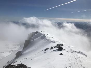
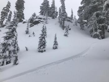
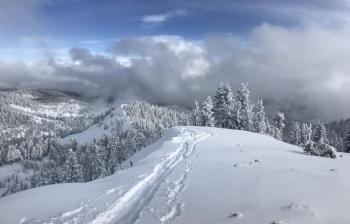
No avalanches or significant signs of instability were observed by skiers and riders yesterday in several areas on the south side of Mount Shasta including Giddy Giddy Gulch, the Old Ski Bowl, Red Butte and Grey Butte. Skies remained overcast for most of the day limiting visibility and observations above treeline.
- Minimal wind loading observed near treeline and no wind slabs encountered
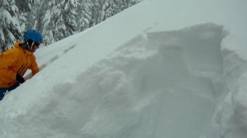
- No evidence of a storm slab problem – the new snow is right-side-up and is well bonded to itself and to the old snow surface
- Plenty of low density snow exists at the snow surface and is available for transport (ski penetration up to 30cm/1ft)
- Minor sloughing observed in steep rocky terrain
- Roller balls and pinwheels observed on steep slopes below treeline
- The height of snow above 7,000 ft on Mount Shasta ranges from 150-300cm/5-8ft and the recent storm has dramatically improved coverage
Weather and Current Conditions
Weather Summary
A weak upper level ridge of high pressure is building into the area today bringing dry and clear weather. Expect sunny skies and highs near 30 degrees. Light and variable winds are expected this morning, but winds will shift to the west and may increase to 15-20 mph above treeline throughout the day. Tonight will be clear and cold. Tomorrow will be sunny with increasing clouds in the evening as a strong low-pressure system approaches from the west bringing a chance for precipitation Wednesday and Thursday.
24 Hour Weather Station Data @ 6:00 AM
| Weather Station | Temp (°F) | Wind (mi/hr) | Snow (in) | Comments | ||||||||
|---|---|---|---|---|---|---|---|---|---|---|---|---|
| Cur | Min | Max | Avg | Avg | Max Gust | Dir | Depth | New | Water Equivalent | Settlement | ||
| Mt. Shasta City (3540 ft) | 17 | 17 | 39 | 28 | 3 | N | ||||||
| Sand Flat (6750 ft) | station down | |||||||||||
| Ski Bowl (7600 ft) | 13.5 | 9.5 | 37 | 20 | 62.5 | 2.5 | 0.04 | 4.5 | ||||
| Gray Butte (8000 ft) | 13 | 10 | 28 | 17 | 4 | 18 | WNW | |||||
| Castle Lake (5870 ft) | 20.5 | 16 | 34 | 23.5 | 30.5 | 1.5 | 4 | |||||
| Mount Eddy (6509 ft) | 10 | 10 | 25.5 | 16.5 | 2 | 8 | WSW | 46 | .5 | 3 | ||
| Ash Creek Bowl (7250 ft) | station down | |||||||||||
| Ash Creek Ridge (7895 ft) | station down |
Two Day Mountain Weather Forecast
Produced in partnership with the Medford NWS
| For 7000 ft to 9000 ft | |||
|---|---|---|---|
|
Monday (4 a.m. to 10 p.m.) |
Monday Night (10 p.m. to 4 a.m.) |
Tuesday (4 a.m. to 10 p.m.) |
|
| Weather | Sunny | Mostly clear | Mostly sunny |
| Temperature (°F) | 33 | 22 | 41 |
| Wind (mi/hr) | N/NE 0-5 mi/hr | E 0-5 mi/hr | E/SE 0-5 mi/hr |
| Precipitation SWE / Snowfall (in) | / 0 | / 0 | / 0 |
| For 9000 ft to 11000 ft | |||
| Monday | Monday Night | Tuesday | |
| Weather | Sunny and cold | Mostly clear | Mostly sunny |
| Temperature (°F) | 18 | 18 | 22 |
| Wind (mi/hr) | W 15-20 mi/hr | W 0 | SW 15-20 mi/hr |
| Precipitation SWE / Snowfall (in) | / 0 | / 0 | / 0 |
Season Precipitation for Mount Shasta City
| Period | Measured (in) | Normal (in) | Percent of Normal (%) |
|---|---|---|---|
| From Oct 1, 2024 (the wet season) | 12.20 | 30.53 | 40 |
| Month to Date (since Apr 1, 2025) | 1.31 | 1.03 | 127 |
| Year to Date (since Jan 1, 2025) | 6.37 | 15.32 | 42 |


