You are here
Avalanche Advisory for 2018-03-10 06:05
- EXPIRED ON March 11, 2018 @ 7:05 amPublished on March 10, 2018 @ 6:05 am
- Issued by Nick Meyers - Shasta-Trinity National Forest
Bottom Line
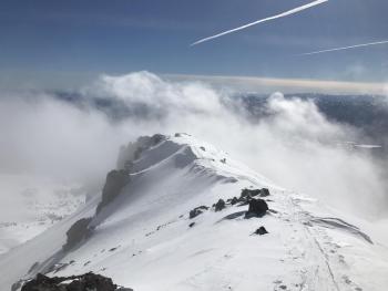
The avalanche danger is LOW for all elevations and aspects and NORMAL CAUTION is advised. Watch for falling rime ice off the upper mountain. Shallow buried objects such as rocks and forest debris continue to pose a risk in some areas.
Avalanche Problem 1: Normal Caution
-
Character ?

-
Aspect/Elevation ?

-
Likelihood ?CertainVery LikelyLikelyPossible
 Unlikely
 -
Size ?HistoricVery LargeLargeSmall

Generally safe avalanche conditions exist in the backcountry. Always be on the lookout for isolated wind slabs above treeline. They are generally related to wind and terrain: look for places where small areas of drifting have occurred and firm layers of surface snow overlie softer layers. Often this will occur on the lee side of ridges, in terrain depressions, on convex terrain features, and in the lee of isolated bands of trees.
Forecast Discussion
Expect warming temperatures over the next couple days. Sticky snow will keep skiers on their toes, but hopefully not on their face. Signs of avalanche danger have been tough to find. Climbing the mountain this weekend? Once again, watch for falling rime ice and rockfall.
Recent Observations
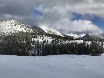
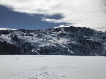
Isolated snow showers came in waves during a snow survey outing into the Deadfall Lakes / Eddy Mountains area yesterday. Snow levels were near 5,500 feet. Skies were obscured and low fog shrouded the mountains, keeping visibility poor for most of the day. In the afternoon, the weather began to clear and patches of blue sky could be seen through the clouds. By evening, things had cleared off almost completely. Average snow depth at lower Deadfall Lake was 28.5 inches. A couple inches of moist, new snow rest on top of the old snow surfaces. Roller balls were observed on aspects facing the sunny side of the compass. When the sun did pop out, trees off-loaded snow by dripping like crazy. No old or recent avalanches could be observed. Overall stability in the area was good. Shallow buried objects were abundant.
On Mt Shasta in the last 24 hours:
- .53 inches of water
- 1-2 inches of new, wet snow
- Light winds out of the W/NW
Weather and Current Conditions
Weather Summary
An upper level low makes its way toward the coast this morning bringing isolated showers to the area. Little to no accumulation can be expected. Any precipitation will likely be concentrated in the mountains due to orographic effects. The low moves off to the north tonight and ridging develops over the area tomorrow. Warm air aloft and sunny skies will provide a warm day Sunday. Monday will be a transition as a strong, westerly moving storm system approaches. South/Southeast wind will pick up and precipitation will likely begin in higher terrain. Overall, next week will be a gradual return to cooler, wetter weather.
24 Hour Weather Station Data @ 4:00 AM
| Weather Station | Temp (°F) | Wind (mi/hr) | Snow (in) | Comments | ||||||||
|---|---|---|---|---|---|---|---|---|---|---|---|---|
| Cur | Min | Max | Avg | Avg | Max Gust | Dir | Depth | New | Water Equivalent | Settlement | ||
| Mt. Shasta City (3540 ft) | 28 | 28 | 48 | 39 | 1 | N | ||||||
| Sand Flat (6750 ft) | station down | |||||||||||
| Ski Bowl (7600 ft) | 25.5 | 21.5 | 35 | 27 | 63 | 2 | 0.53 | 1.5 | ||||
| Gray Butte (8000 ft) | 26 | 22.5 | 33.5 | 27 | 10 | 25 | W | |||||
| Castle Lake (5870 ft) | 30 | 30 | 52.5 | 34.5 | 26 | 1 | 2.5 | |||||
| Mount Eddy (6509 ft) | 26 | 21.5 | 38.5 | 29 | 2 | 9 | WSW | 40 | 1 | 0 | ||
| Ash Creek Bowl (7250 ft) | station down | |||||||||||
| Ash Creek Ridge (7895 ft) | station down |
Two Day Mountain Weather Forecast
Produced in partnership with the Medford NWS
| For 7000 ft to 9000 ft | |||
|---|---|---|---|
|
Saturday (4 a.m. to 10 p.m.) |
Saturday Night (10 p.m. to 4 a.m.) |
Sunday (4 a.m. to 10 p.m.) |
|
| Weather | Partly cloudy, isolated rain and snow showers this afternoon. | Partly cloudy with isolated rain and snow showers in the evening, clearing overnight. | Sunny |
| Temperature (°F) | 42 | 31 | 48 |
| Wind (mi/hr) | SE 0-5 mi/hr | S 0-5 mi/hr | E 0-5 mi/hr |
| Precipitation SWE / Snowfall (in) | / 0 | / 0 | / 0 |
| For 9000 ft to 11000 ft | |||
| Saturday | Saturday Night | Sunday | |
| Weather | Partly cloudy with isolated snow showers, breezy. | Partly cloudy with isolated snow showers, breezy, clearing | Sunny |
| Temperature (°F) | 23 | 23 | 29 |
| Wind (mi/hr) | SW 5-15 mi/hr | SW 0 | S 5-10 mi/hr |
| Precipitation SWE / Snowfall (in) | / 0 | / 0 | / 0 |
Season Precipitation for Mount Shasta City
| Period | Measured (in) | Normal (in) | Percent of Normal (%) |
|---|---|---|---|
| From Oct 1, 2024 (the wet season) | 12.52 | 31.92 | 39 |
| Month to Date (since Apr 1, 2025) | 1.63 | 2.42 | 67 |
| Year to Date (since Jan 1, 2025) | 6.69 | 16.71 | 40 |


