You are here
Avalanche Forecast for 2020-01-29 06:00
- EXPIRED ON January 30, 2020 @ 6:00 amPublished on January 29, 2020 @ 6:00 am
- Issued by Aaron Beverly - Mount Shasta Avalanche Center
Bottom Line
Avalanche danger is LOW. Look for small wind slabs in isolated or extreme terrain. Pay attention to the consequences of being swept off your feet. Otherwise exercise normal caution.
Avalanche Problem 1: Wind Slab
-
Character ?

-
Aspect/Elevation ?

-
Likelihood ?CertainVery LikelyLikelyPossible
 Unlikely
 -
Size ?HistoricVery LargeLargeSmall

You may find small, isolated wind slabs out there. Look for them primarily on easterly aspects or cross loaded areas facing to the north and south.
Stomp around on convex, newly wind drifted areas of no consequence. Do you get something to move in a blocky consolidated manner? If so, avoid loaded terrain with angles greater than 35 degrees. You could be swept into undesirable terrain. Pay attention to consequences when traveling near steep slopes.
Otherwise exercise normal caution. Bring the tools and skills necessary for avalanche rescue.
Recent Observations
Mount Shasta has received 1-3 inches of moist to dry snow above 5,000 ft. Winds have been light to moderate out of the west. Temperatures have ranged from 23 to 33 degrees.
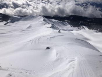
New snow has freshened the snowpack nicely with very little wind affect seen at all elevations. Ridgelines are lightly scoured. No notable signs of a wind slab problem were seen on Mount Shasta. Outlier regions such as Ash Creek Butte saw some small wind slab issues on isolated terrain.
Weather and Current Conditions
Weather Summary
A building ridge of high pressure looks to keep us mostly dry for the foreseeable future. Winds will be northerly, strong at times high in the alpine, but light to moderate below; probably calm below treeline. Snow levels are on the rise - 7,500 ft today and tonight. If you find any falling snow, it'll be a few flurries late tonight, but no accumulation is expected. The cloud base should be well above 15,000 ft for most of the day.
24 Hour Weather Station Data @ 5:00 AM
| Weather Station | Temp (°F) | Wind (mi/hr) | Snow (in) | Comments | ||||||||
|---|---|---|---|---|---|---|---|---|---|---|---|---|
| Cur | Min | Max | Avg | Avg | Max Gust | Dir | Depth | New | Water Equivalent | Settlement | ||
| Mt. Shasta City (3540 ft) | 32 | 29 | 43 | 37 | 2 | N | ||||||
| Sand Flat (6750 ft) | 24 | 23 | 33 | 28 | 53 | 1 | 0 | 1 | ||||
| Ski Bowl (7600 ft) | 24 | 23 | 32.5 | 26 | 71.2 | 3 | 0.12 | 2 | ||||
| Gray Butte (8000 ft) | 23.5 | 20.5 | 29.5 | 24.5 | 12 | 37 | WNW | |||||
| Castle Lake (5870 ft) | down | |||||||||||
| Mount Eddy (6509 ft) | 33 | 26 | 33 | 29 | 1 | 12 | SSE | 48.4 | 2 | 1 | ||
| Ash Creek Bowl (7250 ft) | down | |||||||||||
| Ash Creek Ridge (7895 ft) | down |
Two Day Mountain Weather Forecast
Produced in partnership with the Medford NWS
| For 7000 ft to 9000 ft | |||
|---|---|---|---|
|
Wednesday (4 a.m. to 10 p.m.) |
Wednesday Night (10 p.m. to 4 a.m.) |
Thursday (4 a.m. to 10 p.m.) |
|
| Weather | A 10 percent chance of rain after 4 p.m. | A 10 percent chance of rain after 4 p.m. | A 20 percent chance of rain before 10 a.m. Snow level 8,000 feet. Partly sunny. |
| Temperature (°F) | 39 | 37 | 41 |
| Wind (mi/hr) | West 5-10 | Northwest 0-5 | Northwest 0-5 |
| Precipitation SWE / Snowfall (in) | 0.00 / 0 | 0.00 / 0 | 0.00 / 0 |
| For 9000 ft to 11000 ft | |||
| Wednesday | Wednesday Night | Thursday | |
| Weather | A 20 percent chance of snow after 10 a.m. Mostly cloudy, with a high near 26. Breezy. | A 30 percent chance of snow, mainly between 10 p.m. and 4 a.m. Mostly cloudy. Breezy. Little or no snow accumulation expected. | A 20 percent chance of snow before 10 a.m. Partly sunny. Breezy. |
| Temperature (°F) | 28 | 22 | 32 |
| Wind (mi/hr) | North 10-20 | North 10-20 | North 10-20 |
| Precipitation SWE / Snowfall (in) | 0.00 / 0 | 0.00 / 0 | 0.00 / 0 |
Season Precipitation for Mount Shasta City
| Period | Measured (in) | Normal (in) | Percent of Normal (%) |
|---|---|---|---|
| From Oct 1, 2024 (the wet season) | 12.78 | 21.64 | 59 |
| Month to Date (since Apr 1, 2025) | 3.85 | 6.43 | 60 |
| Year to Date (since Jan 1, 2025) | 3.85 | 6.43 | 60 |


