You are here
Avalanche Forecast for 2020-12-23 05:30
- EXPIRED ON December 24, 2020 @ 5:30 amPublished on December 23, 2020 @ 5:30 am
- Issued by Aaron Beverly - Mount Shasta Avalanche Center
Bottom Line
Avalanche danger is LOW. Exercise normal caution. A small Christmas day miracle is on the way with 9-16 inches of snow expected above 4,000 ft.
Avalanche Problem 1: Normal Caution
-
Character ?

-
Aspect/Elevation ?

Avalanche danger is LOW, but remain in the game by thinking about terrain, weather, snowpack, and the human factor. Ninety percent of avalanches are caused by you - the human being. Be aware of how your decisions impact you and your group as you travel in and near avalanche terrain.
An impactful storm is scheduled to arrive Christmas day. Dust off your gear, clean the mice nests out of your boots, and get your shovel, probe, and transceiver ready.
Forecast Discussion
We respectfully request that 4-wheeling enthusiasts refrain from using lower Sand Flat road. It is time to let this area go to non-motorized use for the winter. Thank you.
Recent Observations
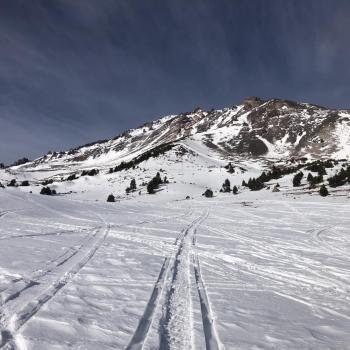
About a half an inch of new snow greeted winter seekers yesterday morning. Not much, but the refresh made cross country skiing around Sand Flat quite pleasant. Downhill skiers may want to convert to the horizontal shuffle for the next couple of days.
You'll find 20-24 inches of snow near and below treeline. Most of this has become crusty and post-holey. There are some sugary layers within this shallow snowpack, but most start zones and avalanche terrain are devoid of snow making these weak layers less of a concern. Remember the above treeline picture below after Friday's storm - rocks galore with a tinge of white.
The Sand Flat snow depth sensor is out of commission and will require hauling bags of concrete and water to fix. Ugh! We are working with the California Department of Water Resources to assess the feasibility of fixing this before the full onset of winter.

Weather and Current Conditions
Weather Summary
I don't want to jinx it, but Friday's storm is shaping up to be a small Christmas miracle. With 1.59 inches of precipitable water now predicted, we could see 9-16 inches of snow above 4,000 ft. This will fall mostly in the afternoon and night.
Until then expect clear, cold, sunny weather.
24 Hour Weather Station Data @ 5:00 AM
| Weather Station | Temp (°F) | Wind (mi/hr) | Snow (in) | Comments | ||||||||
|---|---|---|---|---|---|---|---|---|---|---|---|---|
| Cur | Min | Max | Avg | Avg | Max Gust | Dir | Depth | New | Water Equivalent | Settlement | ||
| Mt. Shasta City (3540 ft) | 34 | 28 | 54 | 39.5 | 4 | |||||||
| Sand Flat (6750 ft) | 17 | 16 | 30 | 22 | 24 | 0 | Snow depth measured by hand. Depth sensor not working. | |||||
| Ski Bowl (7600 ft) | 33 | 16.5 | 38 | 27.5 | 20.4 | 0 | 0 | 0.3 | ||||
| Gray Butte (8000 ft) | 31 | 15.5 | 31 | 25 | 13 | 61 | E | |||||
| Castle Lake (5870 ft) | 24.5 | 20.5 | 25.5 | 23 | 6.8 | 0.8 | 0 | |||||
| Mount Eddy (6509 ft) | 26 | 18.5 | 31 | 25.5 | 2 | 6 | SE | 15.6 | 0 | 0.8 | ||
| Ash Creek Bowl (7250 ft) | 28 | 14 | 28 | 21.5 | 23.9 | 0 | 0.2 | |||||
| Ash Creek Ridge (7895 ft) | 22 | 9 | 22.5 | 17.5 |
Two Day Mountain Weather Forecast
Produced in partnership with the Medford NWS
| For 7000 ft to 9000 ft | |||
|---|---|---|---|
|
Wednesday (4 a.m. to 10 p.m.) |
Wednesday Night (10 p.m. to 4 a.m.) |
Thursday (4 a.m. to 10 p.m.) |
|
| Weather | Sunny. | Clear. | Mostly sunny. |
| Temperature (°F) | 38 | 23 | 37 |
| Wind (mi/hr) | East 0-5 | Southeast 0-5 | South 5-10 |
| Precipitation SWE / Snowfall (in) | 0.00 / 0 | 0.00 / 0 | 0.00 / 0 |
| For 9000 ft to 11000 ft | |||
| Wednesday | Wednesday Night | Thursday | |
| Weather | Sunny. | Clear. | Mostly sunny. Windy |
| Temperature (°F) | 39 | 38 | 38 |
| Wind (mi/hr) | East 5-10 | South 10-15 | South 30-35 |
| Precipitation SWE / Snowfall (in) | 0.00 / 0 | 0.00 / 0 | 0.00 / 0 |
Season Precipitation for Mount Shasta City
| Period | Measured (in) | Normal (in) | Percent of Normal (%) |
|---|---|---|---|
| From Oct 1, 2024 (the wet season) | 2.42 | 12.88 | 19 |
| Month to Date (since Apr 1, 2025) | 0.72 | 5.52 | 13 |
| Year to Date (since Jan 1, 2025) | 15.33 | 40.88 | 38 |


