You are here
Avalanche Forecast for 2021-04-09 06:04
- EXPIRED ON April 10, 2021 @ 6:04 amPublished on April 9, 2021 @ 6:04 am
- Issued by Nick Meyers - Shasta-Trinity National Forest
Bottom Line
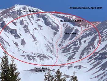
Avalanche danger is low and normal caution is advised in the backcountry. For climbers, falling rock and slips and falls are the main concern. This hazard should be considered in between Helen Lake and Redbanks, or any other steep slope with exposed rock overhead. Strong northwesterly wind will build into Saturday and die off Sunday/Monday. Expect clear skies overall.
Avalanche Problem 1: Normal Caution
-
Character ?

-
Aspect/Elevation ?

-
Likelihood ?CertainVery LikelyLikelyPossible
 Unlikely
 -
Size ?HistoricVery LargeLargeSmall

Normal caution is advised in the backcountry. The spring climbing season is here. Falling rock and slips and falls are the main concern and one of Mount Shasta's most common accident. The majority of these accidents happen in between Helen Lake and Redbanks. Keep your head up and helmet on and know how use your ice axe and crampons.
Warm spring sunshine will melt snow surfaces and loose wet avalanches and/or cornice breaks are not impossible. Do you see rollerballs and pinwheels? Are you sinking up to your ankles? If so, avoid steep slopes, choose a different aspect or get an earlier start.
Forecast Discussion
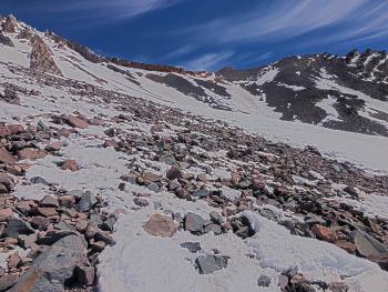
We've had dry winter. Precipitation is 48% of normal. High wind events have left the upper mountain scoured and rocky. Climbs this season will have more risk than normal. The optimal climbing season has been pushed months earlier this year. If you plan to climb Mount Shasta, now is the time. The climbing routes around The Heart and through the Red Banks in Avalanche Gulch are already narrow or melted out.
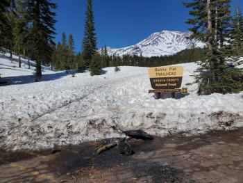
The Bunny Flat trailhead is the only open trailhead accessible by vehicle at this time. Your required items to climb Mt. Shasta, a summit pass, wilderness permit, and human waste packout bag, can be attained at the McCloud or Mount Shasta Ranger Stations (self-issue) or at The Fifth Season in Mount Shasta. For annual passes, The Fifth Season is the best option. Bunny Flat trailhead also has a self-issue kiosk for all items. A summit pass ($25/3-days) is required to climb anywhere above 10,000 feet, even if you don't plan on going to the summit. A wilderness permit (free) is required to enter the MS Wilderness. Human waste "wag bags" are provided for free at open trailheads, and it is required to packout your poop, please and thank you!
Recent Observations
Over the past 24 hours, west/northwest wind has averaged 6 mi/hr with gusts to 24 mi/hr. Temperatures peaked at 44 ºF and bottomed out at 28.5 ºF. The snow depth at the Old Ski Bowl is 65 in, 2.1 inches less than yesterday morning. At Castle Lake, the current snow depth is 53 inches, with a high temperature of 50 ºF and low of 31 ºF.
Mt. Shasta Wilderness trailhead access is still prolonged. Despite the looks of things above treeline on the mountain, 50-60 inches of snow still remains below and near treeline. Clear Creek trailhead is 6-7 miles out, Northgate about 3.9 miles and Brewer Creek trailhead about 16.5 miles out. You are welcome to access these trailheads, but a snowmobile or good set of legs is necessary. Bunny Flat remains the only open and vehicle accessible trailhead at this time. This trailhead accessed the entire south and west facing routes on the mountain, including Shastina. There is no running water at Bunny Flat or on the mountain right now.
Spring skiing this year is a bit of a bust. That said, turns can still be had and one can ski all the way to Bunny Flat. Expect variable conditions. Climbers have been attempting the mountain with some success. The skies have been clear, but wind has thwarted a some attempts. Rockfall has been observed on the Avalanche Gulch route in between Helen Lake and Redbanks. The snow is supportable in the morning hours and soft in the afternoon. We have not observed any loose-wet avalanches recently.
Sand Flat still has snow for cross-country skiing and snowshoeing. Check out the upper or lower road off the Everitt Memorial Highway for access. Motorized/snowmobile access from Bunny Flat into the Old Ski Bowl is still possible. Make sure you are familiar with the riding boundaries, please.
Weather and Current Conditions
Weather Summary
Mostly clear skies prevail. Northwesterly wind will build into Saturday with speeds 25-35 mi/hr and gusts higher over exposed terrain. On Sunday and into Monday, the wind will die off. Daytime high temperatures will be in the mid to upper 40's below treeline and in the low to mid 30's above treeline. Winter weather seems to be a thing of the past.
24 Hour Weather Station Data @ 3:00 AM
| Weather Station | Temp (°F) | Wind (mi/hr) | Snow (in) | Comments | ||||||||
|---|---|---|---|---|---|---|---|---|---|---|---|---|
| Cur | Min | Max | Avg | Avg | Max Gust | Dir | Depth | New | Water Equivalent | Settlement | ||
| Mt. Shasta City (3540 ft) | 31 | 31 | 62 | 46.5 | 4 | |||||||
| Sand Flat (6750 ft) | 27 | 27 | 44 | 36 | Snow sensor down | |||||||
| Ski Bowl (7600 ft) | 33.5 | 28.5 | 44 | 37 | 64.8 | 0 | 0 | 2.1 | ||||
| Gray Butte (8000 ft) | 35 | 29.5 | 42.5 | 36 | 6 | 43 | WNW | |||||
| Castle Lake (5870 ft) | 38 | 31 | 50 | 40.5 | 53.3 | 0 | 1.8 | |||||
| Mount Eddy (6509 ft) | 29.5 | 26.5 | 43.5 | 34.5 | 2 | 6 | WSW | 54 | 0 | 2.3 | ||
| Ash Creek Bowl (7250 ft) | 33 | 14 | 33 | 23.5 | 69.4 | 0 | 0.5 | |||||
| Ash Creek Ridge (7895 ft) | 34 | 23.5 | 41 | 32 | 10 | 28 | W |
Two Day Mountain Weather Forecast
Produced in partnership with the Medford NWS
| For 7000 ft to 9000 ft | |||
|---|---|---|---|
|
Friday (4 a.m. to 10 p.m.) |
Friday Night (10 p.m. to 4 a.m.) |
Saturday (4 a.m. to 10 p.m.) |
|
| Weather | Sunny | Clear | Sunny |
| Temperature (°F) | 49 | 24 | 43 |
| Wind (mi/hr) | Northwest 5-10 | Northwest 5-10 | Northwest 5-10 |
| Precipitation SWE / Snowfall (in) | 0.00 / 0 | 0.00 / 0 | 0.00 / 0 |
| For 9000 ft to 11000 ft | |||
| Friday | Friday Night | Saturday | |
| Weather | Sunny | Clear and windy | Sunny and windy |
| Temperature (°F) | 30 | 21 | 31 |
| Wind (mi/hr) | West 10-20 | Northwest 25-35 | Northwest 25-35 |
| Precipitation SWE / Snowfall (in) | 0.00 / 0 | 0.00 / 0 | 0.00 / 0 |
Season Precipitation for Mount Shasta City
| Period | Measured (in) | Normal (in) | Percent of Normal (%) |
|---|---|---|---|
| From Oct 1, 2024 (the wet season) | 17.15 | 36.37 | 47 |
| Month to Date (since Apr 1, 2025) | 0.00 | 0.91 | 0 |
| Year to Date (since Jan 1, 2025) | 13.57 | 21.16 | 64 |


