You are here
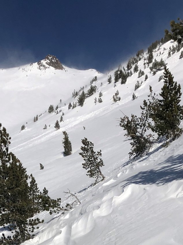
Avalanche on W aspect 8,700 feet lower Casaval Ridge (Giddy Giddy Gulch)

Location Name:
West facing skier's left side Giddy Giddy Gulch, lower Casaval Ridge 8,700 feetRegion:
Mt. ShastaDate and time of avalanche (best estimate if unknown):
Tue, 12/25/2018 - 8:00amObservation made by:
Professional ObserverRed Flags:
Recent avalanche activity
Recent loading by new snow, wind, or rain
Location Map
96067
Mount Shasta
, CA
United States
41° 22' 44.5224" N, 122° 13' 36.876" W
See map: Google Maps
California US
Avalanche Observations
Details
Photos
Characteristics
Avalanche Type:
SlabTrigger type:
NaturalSlope:
35degreesAspect:
WestElevation:
8 700ft.Terrain:
Above TreelineWeak Layer:
Other - explain belowBed Surface:
Old SnowAvalanche Length:
200ft.Weather Observations
Details
Skies were clear above 6,900 feet with a mix of lower clouds below. Wind out of the north were gusting down Avalanche Gulch. Large plums of blowing snow were observed above treeline. These winds were very productive striping any exposed windward surfaces and packing low lying leeward areas.
Statistics
Cloud Cover:
ClearBlowing Snow:
YesPrecipitation:
NoneAccumulation rate:
Less than 1 in. per hourAir temperature:
Below FreezingAir temperature trend:
StaticWind Speed:
StrongWind Direction:
North


Location: Lower Casaval Ridge (Giddy Giddy Gulch), 8,700 feet W aspect
Time of Occurance: 20181225, early morning during wind event, 8 a.m.?
Path Characteristic: W aspect, crown not visible, 30 - 40 degree slope, starting zone in steep stunted trees
Event Characteristic: D1R1, Windslab, Natural. Likely ran on melt freeze crust from Dec 19th warming event or Dec 14th rain crust? No other activity in area observed. See snowpack observation and pit profile from event here: https://www.shastaavalanche.org/snowpack-observation/strong-wind-lower-c...