You are here
Natural Wind Slab Avalanche

Location Name:
Avalanche GulchRegion:
Mt. ShastaDate and time of avalanche (best estimate if unknown):
Fri, 12/27/2019 - 11:30amObservation made by:
ForecasterRed Flags:
Recent avalanche activity
Whumphing noises, shooting cracks, or collapsing
Recent loading by new snow, wind, or rain
Location Map
96067
Mount Shasta
, CA
United States
41° 22' 8.4612" N, 122° 13' 18.1308" W
See map: Google Maps
California US
Avalanche Observations
Details
Photos
Characteristics
Avalanche Type:
SlabTrigger type:
NaturalSlope:
37degreesAspect:
NorthwestElevation:
8 200ft.Terrain:
Near TreelineWeak Layer:
Old SnowBed Surface:
Other - explain belowCrown Height:
2 ftAvalanche Width:
100ft.Avalanche Length:
500ft.Number of people caught:
0Number of partial burials:
0Number of full burials:
0Weather Observations
Details

Statistics
Cloud Cover:
ClearBlowing Snow:
YesPrecipitation:
NoneAccumulation rate:
NoneAir temperature:
Below FreezingAir temperature trend:
WarmingWind Speed:
Gale ForceWind Direction:
Northwest


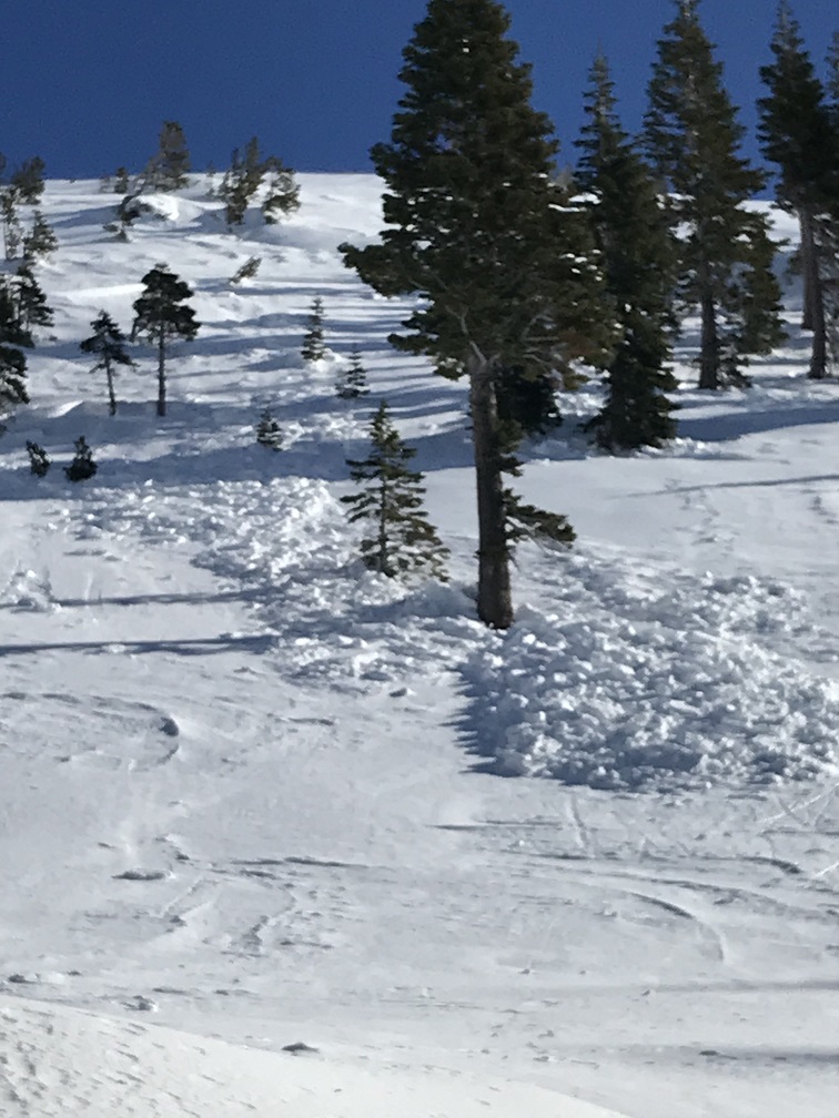
This natural trigger, wind slab avalanche was witnessed and observed at 1130 hours on 12.27.19. It occurred near treeline on a W/NW facing aspect off Green Butte Ridge/Broadway and slid into Avalanche Gulch through sparse trees. Avalanche size of D1.5. This avalanche was relatively small but big enough to potentially bury someone in a terrain trap and certainly big enough to sweep someone off their feet into undesirable terrain such as trees in this case. Estimated crown height was 18 inches tall and 100 feet wide. It is our best guess at this point that the avalanche failed on the 12/19 ice crust.
A strong, northwest wind event was very productive in moving a ton of snow around (visible in photos). Leeward aspects were actively being wind loaded and some slopes, like this one, cross-loaded. Exposed ridgelines and other windy terrain were completely stripped of the previous 6-12 inches of low density snow. This has left behind the 12/19 ice crust.