You are here
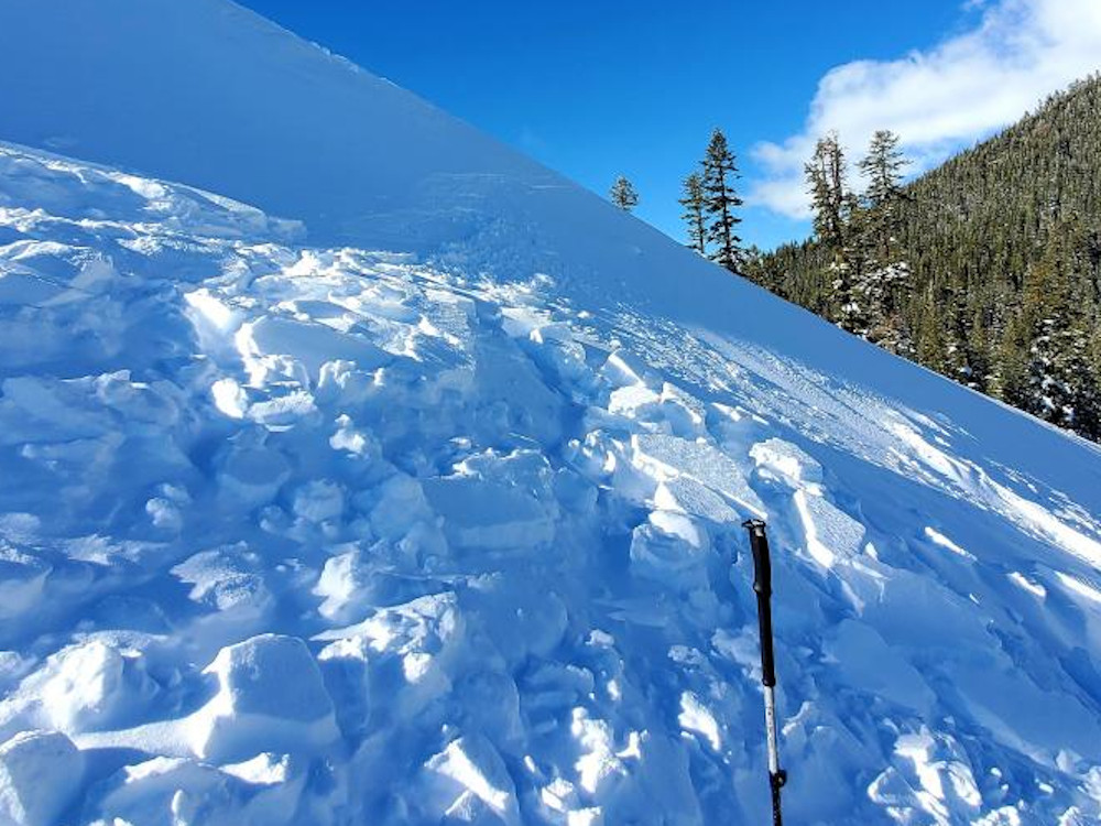
Small Slide Observed on E/NE Aspect Near Treeline

Location Name:
Backside of CoyoteRegion:
Mt. ShastaDate and time of avalanche (best estimate if unknown):
Sat, 01/08/2022 - 1:00pmObservation made by:
PublicRed Flags:
Recent avalanche activity
Location Map
96067
Mount Shasta
, CA
United States
41° 20' 4.9344" N, 122° 11' 39.0696" W
See map: Google Maps
California US
Avalanche Observations
Photos
Characteristics
Avalanche Type:
SlabTrigger type:
NaturalSlope:
37degreesAspect:
EastElevation:
6 800ft.Terrain:
Near TreelineWeak Layer:
Storm SnowBed Surface:
Old SnowCrown Height:
Less than 1 ftAvalanche Width:
30ft.Avalanche Length:
30ft.Number of people caught:
0Weather Observations
Details
Statistics
Cloud Cover:
ClearPrecipitation:
NoneAir temperature:
Above FreezingAir temperature trend:
WarmingWind Speed:
Calm


AM bellow 20F, afternoon 35F
First big warming event since prior to the last storm cycle.
This small slide (D.5) slid on the rain/freeze layer. This is suspected to have initiated under a cornice forming on leeward terrain some time before noon. We do not think it was caused from cornice break.
ECTN 20 at the rain/freeze crust 20cm bellow surface. *This site experiences skier compaction, though the new snow fall from 1/6-7 had not yet seen skier traffic before this slid occurred.
My thoughts are that this wind slab was touchy in the am with cool overnight lows, then trended towards stable throughout the day with gradually warming temps.