You are here
03-04-2016-West Face
General Conditions
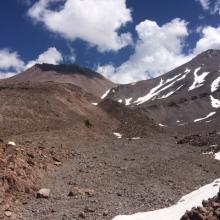
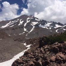
The West Face via Hidden Valley (HV) is in full winter conditions. An approaching storm tonight (3-4-2016) is forecast to bring 3+ inches of water which translates into 2+ feet of new snow. Avalanche danger will increase making above treeline travel more hazardous. Winds are predicted to reach near hurricane speeds of 60-70 mph on the mountain upper elevations (10,000 feet and up). Low visibility in "white out" conditions will also be a factor. March is predicted to be quite wet with active storm patterns. Wait for a solid window in the weather before attempting a climb of the West Face. This route is a more remote option than Avalanche Gulch via Bunny Flat, and would be more of a challenge to access on snow shoes versus skis or split board due a long traversing approach. Winter worthy gear, winter camping, and winter mountaineering knowledge and skill are a must. Some sections like the top of the West Face are steep, and in firm snow conditions present the possibility of a long fall. The ridge lines of the WF are exposed. If you do not have previous winter mountaineering skill, experience using map and compass to navigate winter terrain, and/or proper, light weight winter worthy gear we advise you to pick a different route or plan your trip for the spring or early summer! The trail that leads to Hidden Valley from Horse Camp is fully snow covered requiring a map and compass to reach safely. If you feel like you just can't wait until spring for a climb of the West Face, read the current avalanche advisory, watch for a solid break in any winter weather, and give us a call at 530-926-4511 with any other questions.
Camping in HV can be notoriously windy. Anchor your tent well. Water is not available. Snow camping is the only option and available in HV. Fill up your water jugs before leaving home and bring extra fuel to melt snow. It will be your only source of water when on the mountain.
The route from Horse Camp to Hidden Valley is one long, slow ascending, climbers' left traverse. If you ascend too high, you'll have to descend into HV. If you ascend too low, you will have to climb up near the mouth of the valley. Where most people get into trouble is upon the descent. Climbers have a tendency, especially if skiing, to descend too low, too fast. If you do this, you'll end up in either the Sand Flat area or more than likely, in Cascade Gulch somewhere. While you'll come out eventually onto the Everett Memorial Highway, it will add miles to the end of your trip and postpone the delicious brew that may be waiting for you. Getting off route is most common when the trail is covered in snow, not the case currently.
The West Face Route tops out near the bottom of Misery Hill, commonly referred to as the "Upper Mountain." During white out conditions it can be very difficult to find the descent route to the top of the West Face. This has caused numerous search and rescue incidents. It's very easy to wander off the WRONG side of the mountain. The Whitney Glacier and many other routes all converge near Misery Hill and the Summit Plateau. You may quickly find yourself in glaciered terrain which is not a good situation if you are not prepared. Pay attention, don't climb into a white out, know your route, and turn around before conditions worsen.


