You are here
Multiple natural slab avalanches near Ski Area in Lassen NP

Location Name:
SE ridgeline skiers right of Ski Area, Lassen Volcanic National ParkRegion:
Outside of the Forecast AreaDate and time of avalanche (best estimate if unknown):
Sun, 01/22/2017 - 6:00pmObservation made by:
PublicRed Flags:
Recent avalanche activity
Whumphing noises, shooting cracks, or collapsing
Recent loading by new snow, wind, or rain
Location Map
United States
40° 26' 23.73" N, 121° 32' 22.5672" W
See map: Google Maps
US
Avalanche Observations
Details
Snow Pit / Crown Profile Photos
Characteristics
Avalanche Type:
DrySlabTrigger type:
NaturalSlope:
32degreesAspect:
SoutheastElevation:
7 700ft.Terrain:
Near TreelineWeak Layer:
Storm SnowAvalanche Width:
60ft.Avalanche Length:
80ft.Number of similar avalanches:
3Number of people caught:
0Number of partial burials:
0Number of full burials:
0Weather Observations
Details
Statistics
Precipitation:
Accumulation rate:
Air temperature:
Air temperature trend:
Wind Direction:


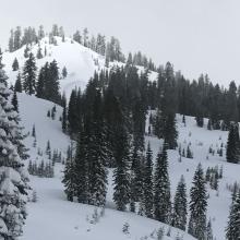
At 10am 22/01/17, observed 3 recent naturally triggered dry slab avalanches in close proximity on SE aspect slope at 7700ft, midway down ridgeline running SE from Brokeoff Mt, skiers right of Ski Area. All 3 avalanches looked distinct, but within a few hundred feet of one another. Slope angle approximately 30-35º. Crown visible, depth looked to be roughly at interface between new & old storm snow, but hard to tell from a distance. Two larger avalanches were approx. 50-60ft wide with 60ft vertical fall, smaller approx. 20ft wide with 10ft vertical fall. Clearly visible from Kohm Ya-mah-nee Visitor Center parking lot (6700ft).