You are here
Avalanche Gulch, Giddy Giddy Gulch, Casaval Ridge

Location Name:
Avalanche GulchRegion:
Mt. ShastaDate and time of observation:
Sat, 02/11/2017 - 9:00pmObservation made by:
ForecasterLocation Map
United States
41° 23' 17.1996" N, 122° 13' 7.6116" W
See map: Google Maps
US
Weather Observations
Details
Any lingering clouds cleared by 0900 this morning and sunny skies prevailed. Winds remained calm up to 9000ft, with light to moderate gusts. Wind direction was variable, but SW, W, and NW winds were observed. Temperatures remained below freezing for almost the entire day, but solar radiation input was significant.
Statistics
Blowing Snow:
YesAir temperature:
Below FreezingAir temperature trend:
WarmingWind Speed:
CalmWind Direction:
Northwest


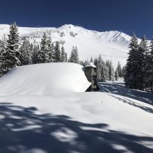
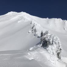
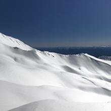
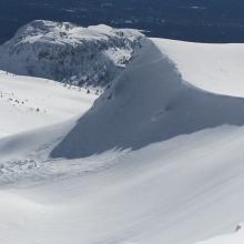


No recent avalanches, or significant signs of instability were observed today. An old cornice fall triggered wind slab avalanche was observed on the north side of Green Butte Ridge (see photo). The avalanche likely ran sometime during the past week. Plumes of blowing snow were visible on several alpine ridges above 9000ft. However, the plumes appeared to be snow sublimation rather than productive wind loading. No new wind slab development was observed today, and any old wind slabs appeared unreactive.
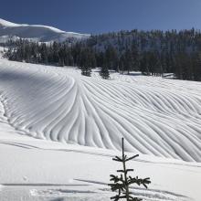
From Bunny Flat (6900ft) up to 10400ft on Casaval ridge, 2-4cm of new snow from the last 24hrs rest atop variable and mostly firm snow surfaces. Impressive rain runnels exist up to 8500ft (see photo). Above 8500ft, runnels taper off quickly, and smooth snow surfaces can be found. Ski penetration of 2-4cm was fairly consistent throughout the day. Boot penetration ranged from 2-10cm. On most south facing slopes 35 degrees and steeper and above 9000ft, very firm and icy surfaces where consistently found to exist below the light recent snow. Ski crampons and/or boot crampons would be very useful on steep slopes above 9000ft with the current conditions.
The solar radiation input today was significant, but snow surfaces stayed cold above 8500ft. Near and below 8500ft, snow surfaces softened and became moist by 1400 this afternoon, and ski turns in terrain 35 degrees and steeper generated roller balls. The most significant instability factor caused by the sun was its affect on rime ice. Several small to large pieces of rime ice in many areas along Casaval Ridge failed from the solar radiation input today. Plenty of rime ice still exists (see photo) and poses a future falling ice concern during the sunny and warm days expected this week.