

You are here
Avalanche Advisory for 2017-12-06 06:45:33
-
EXPIRED ON December 7, 2017 @ 6:45 am
Published on December 6, 2017 @ 6:45 am - Issued by Aaron Beverly - Mount Shasta Avalanche Center
Bottom Line
The avalanche danger is LOW at all elevations throughout the advisory area. Natural and human triggered avalanches are unlikely. Exercise NORMAL CAUTION when traveling in the backcountry. Small wind slabs are unlikely to be seen, but could still linger in some alpine areas unaffected by the current warming trend.


Avalanche Problem 1: Normal Caution
-
Character ?

-
Likelihood ?CertainVery LikelyLikelyPossible
 Unlikely
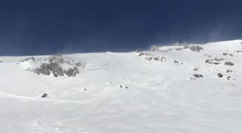
Avalanche danger is LOW at all elevations. LOW avalanche danger does not mean NO avalanche danger. Exercise NORMAL CAUTION while traveling in the backcountry today. Keep your awareness up, travel with a partner, and carry a shovel, beacon, and probe. Monitor changing snow conditions and continue to keep an eye out for small wind slabs on leeward slopes high in the alpine that have remained cold and unexposed to the sun. If snow is wet and your boot penetrates to the cuff, be on the alert for wet loose avalanches.
Forecast Discussion
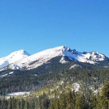
The cycle of warm days and cold nights, that started yesterday, will continue over the next week. This diurnal pattern has mostly diminished any concerns for wind slab avalanches and has and will increase snowpack stability. However, snow remained dry and unconsolidated in some places within the forecast area, most notably near Ash Creek Butte and Clear Creek Trailhead. Therefore, small pockets of instability may still exist. Look for these at the convexities of leeward slopes greater than 35 degrees.
With temperatures approaching the high 40's during the day, roller balls and pinwheels may be seen, indicating the snowpack is loosing strength under the warm sun. If you are sinking up to your ankles in wet snow, wet loose avalanches could occur. These are generally not dangerous, but could catch a skier off guard if triggered.
Recent Observations
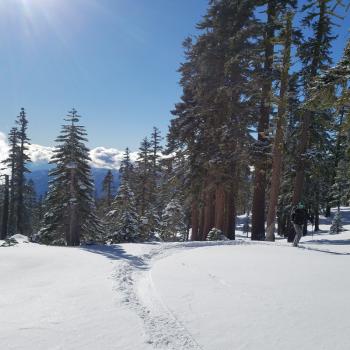
Most of the coverage area including Castle Lake and Mount Shasta saw a rapid warming yesterday with temperatures reaching almost 50 degrees as high as 8000'. Temperatures dropped to near or below freezing during the night with an apparent inversion keeping temperatures higher than expected above 7000'. Springtime conditions prevail in December!
On the east side of Mount Shasta, near Ash Creek Butte and Clear Creek Trailhead, the 4-6" of new snow on the ground remained dry as of Noon. Surface hoar was seen in some places with clear exposure to the sky. With the onset of warm days, these conditions are unlikely to continue for long. If you venture out into these areas, bring a snowmobile or an energetic spirit as your 4-wheel drive will problably not get you any closer than 3 miles from your destination.

Weather and Current Conditions
Weather Summary
The talk of the town is the wall of high pressure sitting right off the northern coast of California directing all potential precipitation up into Canada. A pattern of dry, warm conditions is expected to continue through next week.
But don't despair and move across the border yet. The long term outlook shows normal precipitation and temperatures for the next 3 months. This means that the Shasta winter may be delayed, but is still coming to dinner! And though powder hounds may be dissappointed over the next week, corn skiers may find great spring conditions in the middle of December.
-------------------------
THIS SEASON PRECIPITATION for MT SHASTA CITY: Since October 1st (the wet season), we have received 5.72 inches of water, normal is 8.49 inches, putting us at 67% of normal. For the month of December, we have received .18 inches of water, normal is 1.13 inches, which is 16% of normal. And finally for the year of 2017, we received 44.71 inches of water, normal is 36.49 inches, putting us at 123% of normal.
Always check the weather before you attempt to climb Mt Shasta. Further, monitor the weather as you climb. Becoming caught on the mountain in any type of weather can compromise life and limb. Be prepared.
24 Hour Weather Station Data @
| Weather Station | Temp (°F) | Wind (mi/hr) | Snow (in) | Comments | ||||||||
|---|---|---|---|---|---|---|---|---|---|---|---|---|
| Cur | Min | Max | Avg | Avg | Max Gust | Dir | Depth | New | Water Equivalent | Settlement | ||
| Mt. Shasta City (3540 ft) | 23 | 23 | 40 | |||||||||
| Sand Flat (6750 ft) | 26 | 21 | 42 | 29.7 | 14 | 0 | 0 | |||||
| Ski Bowl (7600 ft) | 40.1 | 33.1 | 47.9 | 39.8 | 18.4 | 0 | 0 | |||||
| Gray Butte (8000 ft) | 42.4 | 34.5 | 47.1 | 40.5 | 7.7 | 30.6 | NE | |||||
| Castle Lake (5870 ft) | 31.8 | 29.7 | 41.8 | 35.8 | 1 | |||||||
| Mount Eddy (6509 ft) | 35.1 | 31.1 | 43 | 35.8 | 2 | 6.7 | WSW | |||||
| Ash Creek Bowl (7250 ft) | Station Down | |||||||||||
| Ash Creek Ridge (7895 ft) | Station Down | |||||||||||
Two Day Mountain Weather Forecast
Produced in partnership with the Medford NWS
| For 7000 ft to 9000 ft | |||
|---|---|---|---|
|
Wednesday (4 a.m. to 10 p.m.) |
Wednesday Night (10 p.m. to 4 a.m.) |
Thursday (4 a.m. to 10 p.m.) |
|
| Weather | Sunny | Clear | Sunny |
| Temperature (°F) | 44 | 32 | 47 |
| Wind (mi/hr) | East 8-10 | East 10-15 | Southeast 10 |
| Precipitation SWE / Snowfall (in) | / 0 | / 0 | / 0 |
| For 9000 ft to 11000 ft | |||
| Wednesday | Wednesday Night | Thursday | |
| Weather | Sunny & Breezy | Clear | Sunny |
| Temperature (°F) | 35 | 35 | 36 |
| Wind (mi/hr) | Northeast 21-33 mph, gusting 47 mph | Southeast 0 | Southeast 14-18 mph |
| Precipitation SWE / Snowfall (in) | / 0 | / 0 | / 0 |

