You are here
Avalanche Advisory for 2018-04-09 07:01
- EXPIRED ON April 10, 2018 @ 7:01 amPublished on April 9, 2018 @ 7:01 am
- Issued by Andrew Kiefer - Mt Shasta Avalanche Center
Bottom Line
Rapid warming and intense solar radiation will create the potential for triggering wet loose avalanches and small cornices. Rime icefall in upper elevation terrain on Mount Shasta will be a significant concern. Avoid traveling in avalanche terrain when snow surfaces are wet and unsupportable.
Avalanche Problem 1: Loose Wet
-
Character ?

-
Aspect/Elevation ?

-
Likelihood ?CertainVery LikelyLikelyPossible
 Unlikely
 -
Size ?HistoricVery LargeLargeSmall

Intense solar radiation will weaken snow surfaces today. Watch for roller balls and pinwheels as signs that wet loose avalanches are possible. By this afternoon, avoid steep sun exposed slopes where the snow is wet and unconsolidated. Small cornices also exist along ridgelines and will weaken throughout the day. Avoid traveling on or underneath these features.
Forecast Discussion
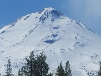
Hot and sunny conditions today will bring well above average temperatures and rapid warming. Alpine rock features are plastered in rime ice, and icefall will be a concern in upper elevation terrain on Mount Shasta, especially in Avalanche Gulch. Despite the warm overnight temperatures, snow surfaces near and above treeline likely froze and will be firm and icy this morning. Snow surfaces will rapidly thaw as the day progresses. Corn-like skiing may be found on southerly aspects with good timing. Wet loose avalanches may become a concern this afternoon on sun-exposed slopes at all elevations.
Recent Observations
The skies cleared mid morning yesterday, bringing sunny, warm and windy weather. Highs at the Old Ski Bowl weather station reached 38 degrees, while overnight lows dropped to 34 degrees. Winds at Gray Butte blew out of the WNW averaging 14 mph with gusts to 28 mph.
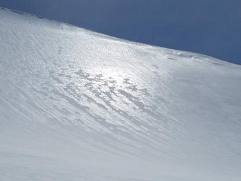
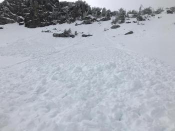
Snow surfaces between 7,000 – 10,000 ft thawed yesterday afternoon in the hot April sun. Below 8,000 ft, the new snow was mushy and wet. Between 8,000-9,000 ft, intense solar radiation broke down the rain crust and it presented as an edge-able, icy sheen. Rain runnels were observed up to 9,000 ft. Above, snow surfaces were surprisingly smooth but somewhat icy. In the afternoon hours, the skiing and riding above 9,000 ft was better than expected. Many southerly slopes were smooth and edge-able, but slightly grabby due a zipper wind crust. Frozen snow surfaces in the early morning hours were extremely icy and firm. No wet loose avalanche activity was observed yesterday. Small cornice features exist at the top of Sun Bowl, Powder Bowl and on Green Butte. Alpine rock features are plastered with rime ice. Blowing snow was seen above 10,000 ft, but no wind slabs were observed.
Weather and Current Conditions
Weather Summary
Today will be warm and sunny with highs in the mid 60s at 7,000 ft. Winds above treeline will blow 10-20 mph out of the SW. Southerly winds will increase tonight, and precipitation is likely to begin tomorrow morning as the first in a series of fronts impacts the area. Precipitation on Tuesday should be light with snow levels near 7,000 ft. The bulk of snow looks to arrive on Wednesday night with snow levels dropping to 5,500 ft. By Thursday, we should receive a total of .69 inches of water, which will come as a mix of rain and high elevation snow.
24 Hour Weather Station Data @ 6:00 AM
| Weather Station | Temp (°F) | Wind (mi/hr) | Snow (in) | Comments | ||||||||
|---|---|---|---|---|---|---|---|---|---|---|---|---|
| Cur | Min | Max | Avg | Avg | Max Gust | Dir | Depth | New | Water Equivalent | Settlement | ||
| Mt. Shasta City (3540 ft) | 32 | 32 | 60 | 45 | 3 | N | ||||||
| Sand Flat (6750 ft) | station down | |||||||||||
| Ski Bowl (7600 ft) | 34.5 | 22.5 | 38.5 | 31.5 | 74.5 | 0 | 0 | 1.5 | ||||
| Gray Butte (8000 ft) | 34.5 | 21.5 | 36 | 30 | 14 | 28 | WNW | |||||
| Castle Lake (5870 ft) | station down | |||||||||||
| Mount Eddy (6509 ft) | 31 | 25 | 43 | 34.5 | 2 | 8 | WSW | 247.5 | 0 | 0 | ||
| Ash Creek Bowl (7250 ft) | station down | |||||||||||
| Ash Creek Ridge (7895 ft) | station down |
Two Day Mountain Weather Forecast
Produced in partnership with the Medford NWS
| For 7000 ft to 9000 ft | |||
|---|---|---|---|
|
Monday (4 a.m. to 10 p.m.) |
Monday Night (10 p.m. to 4 a.m.) |
Tuesday (4 a.m. to 10 p.m.) |
|
| Weather | Sunny | A 20 percent chance of rain after 11pm. Increasing clouds. Windy. | Rain before 11am, then rain and snow. Chance of precipitation 90%. |
| Temperature (°F) | 60 | 37 | 40 |
| Wind (mi/hr) | E 0-5 | S 10-15 | S 10-15 |
| Precipitation SWE / Snowfall (in) | / 0 | / 0 | / 0-1 |
| For 9000 ft to 11000 ft | |||
| Monday | Monday Night | Tuesday | |
| Weather | Sunny and breezy | A 20 percent chance of snow after 11pm. Windy. | Snow and windy. Chance of precipitation 90%. |
| Temperature (°F) | 33 | 26 | 28 |
| Wind (mi/hr) | SW 10-20 | S 0 | SW 40-50 |
| Precipitation SWE / Snowfall (in) | / 0 | / 0 | / 1-2 |
Season Precipitation for Mount Shasta City
| Period | Measured (in) | Normal (in) | Percent of Normal (%) |
|---|---|---|---|
| From Oct 1, 2024 (the wet season) | 17.17 | 36.37 | 47 |
| Month to Date (since Dec 1, 2024) | 1.22 | 0.91 | 134 |
| Year to Date (since Jan 1, 2024) | 11.34 | 21.16 | 54 |


