You are here
Avalanche Forecast for 2020-12-04 06:34
-
EXPIRED ON December 5, 2020 @ 6:34 am
Published on December 4, 2020 @ 6:34 am - Issued by Nick Meyers - Shasta-Trinity National Forest
Bottom Line
The avalanche danger is LOW. Avalanches are not possible at this time due to a thin snowpack. Rock and tree hazards exist above and below the snow surface. Tread lightly, use normal caution and of course... sing/dance/pray for snow!
Avalanche Problem 1: Normal Caution
-
Character ?

-
Aspect/Elevation ?

-
Likelihood ?CertainVery LikelyLikelyPossible
 Unlikely
Avalanche danger is LOW. Exercise normal caution. This is going to be the broken record message for the foreseeable future until we get more snow. Watch out for many not-so-hidden obstacles. Get back into the avalanche awareness mindset. Use safe travel techniques and always bring your shovel, probe, and transceiver.
Forecast Discussion
Our first Know Before You Go avalanche awareness presentation will be held virtually via Zoom tonight December 4th at 7:00 p.m. Save this link for details. Enjoy our special guest Brett Lutz from the National Weather Service. He will kick us off and provide a short 15-minute winter weather outlook for the area. Thanks, Brett! Avalanche awareness to follow. Check us out from the comfort and safety of your home!
Companion Rescue will be held Saturday, December 5th. Masks required. Meet outside at The 5th Season store in Mt Shasta City at 9a.m. Rendezvous at Bunny Flat after for a half day avalanche beacon and rescue refresher. Bring your beacon, shovel and probe.
All educational offerings by the Mt Shasta Avalanche Center are FREE of charge. If you'd like, you can easily DONATE on our website, anytime, any day. Thanks for being you!
Recent Observations
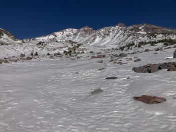
No new observations, just waiting for snow! A few folks have been touring on snow covered roads above 6,500 feet. This includes the Sand Flat winter cross-country ski trails and the Everitt Memorial Highway past the closed gate at Bunny Flat. Some have ventured off-piste up higher in the Old Ski Bowl where and 14 inch base resides. Overall, we don't have enough snow for avalanches or any legit winter sliding and riding!
Our season thus far has included one winter storm beginning on November 17th that brought 20 inches of snow to the mountain. About 12-14 inches remains in areas unaffected by wind. Ridges have lost much of their coverage.
The snowpack in general is right side up. A few crusts are intermingled throughout. Snow surfaces are variable with some cold, low-lying areas hosting sugary, faceted snow. Keep an eye on areas where this weak snow exists before our first big storm. For now, it goes without saying to beware of the many hard obstacles that exist in the snowpack.
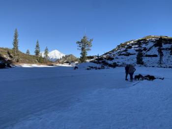
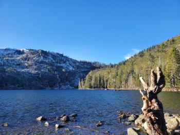
There is no usable snowpack at Castle Lake and temperatures have been staying mostly above freezing. Heart Lake is frozen and local backcountry ice skaters have been enjoying this. Castle Lake and Cliff Lake are not frozen at this time.
Roads are free and clear of snow/ice to Bunny Flat and Castle Lake trailheads. The gate is closed at Bunny Flat and snow exists on the road past the gate, up into the Old Ski Bowl. Sand Flat winter trails are open. Cross-country skiing is possible but conditions marginal. Pilgrim Creek snowmobile park is open, but very little snow exists.
Weather and Current Conditions
Weather Summary
High and dry is not the message we like to be sharing this time of year, but the way 2020 has gone, it's fitting. Today will remain sunny and clear. Late afternoon tomorrow will bring a teaser of precipitation and windy conditions to the mountains. Snow level will reside near 5,000 feet or higher. No need to build excitement as only about a half inch of snow is expected out of this one. I'm guessing if you're reading this, you like snow. Thus, (plug your ears) the disheartening news of continued near to above normal temps, dry conditions, inversions and easterly winds for the extended weather discussion. Cry me a river and let's go boating.
24 Hour Weather Station Data @ 5:00 AM
| Weather Station | Temp (°F) | Wind (mi/hr) | Snow (in) | Comments | ||||||||
|---|---|---|---|---|---|---|---|---|---|---|---|---|
| Cur | Min | Max | Avg | Avg | Max Gust | Dir | Depth | New | Water Equivalent | Settlement | ||
| Mt. Shasta City (3540 ft) | 29 | 29 | 56 | 37 | 1 | N | ||||||
| Sand Flat (6750 ft) | 30 | 29 | 43 | 34 | 9 | 0 | 0 | 0 | ||||
| Ski Bowl (7600 ft) | 36 | 34 | 43.5 | 37 | 14.4 | 0 | 0 | 0.2 | ||||
| Gray Butte (8000 ft) | 38 | 35.5 | 41.5 | 37.5 | 6 | 25 | W | |||||
| Castle Lake (5870 ft) | 37 | 37 | 47.5 | 41 | 7.3 | 2 | 0 | |||||
| Mount Eddy (6509 ft) | 40.5 | 37 | 45 | 40 | 1 | 5 | WSW | 10.2 | 0 | 0 | ||
| Ash Creek Bowl (7250 ft) | n/a | |||||||||||
| Ash Creek Ridge (7895 ft) | n/a | |||||||||||
Two Day Mountain Weather Forecast
Produced in partnership with the Medford NWS
| For 7000 ft to 9000 ft | |||
|---|---|---|---|
|
Friday (4 a.m. to 10 p.m.) |
Friday Night (10 p.m. to 4 a.m.) |
Saturday (4 a.m. to 10 p.m.) |
|
| Weather | Sunny | Mostly clear | Sunny in the morning, then chance of snow (30%) after 4p.m. Up to a half inch expected. Snow level near 5,500 feet. |
| Temperature (°F) | 47 | 33 | 42 |
| Wind (mi/hr) | Northeast 5-10 | East 5-10 | South 5-10 |
| Precipitation SWE / Snowfall (in) | 0.00 / 0 | 0.00 / 0 | 0.02 / 0-0.50 |
| For 9000 ft to 11000 ft | |||
| Friday | Friday Night | Saturday | |
| Weather | Sunny | Mostly clear | Sunny then chance of snow after 4p.m. and windy. Cooling temperatures. |
| Temperature (°F) | 34 | 28 | 31 |
| Wind (mi/hr) | Northeast 5-10 | Variable 10-15 | Southwest 15-25 |
| Precipitation SWE / Snowfall (in) | 0.00 / 0 | 0.00 / 0 | 0.02 / 0-0.50 |
Season Precipitation for Mount Shasta City
| Period | Measured (in) | Normal (in) | Percent of Normal (%) |
|---|---|---|---|
| From Oct 1, 2024 (the wet season) | 1.70 | 8.03 | 21 |
| Month to Date (since May 1, 2025) | 0.00 | 0.67 | 0 |
| Year to Date (since Jan 1, 2025) | 14.61 | 36.03 | 41 |


