You are here
Saint Germain Bowl Avalanche

Location Map
Avalanche Observations
Details
Photos
Characteristics
Weather Observations
Details
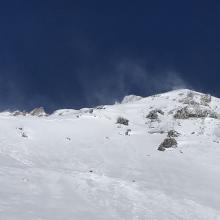
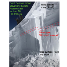
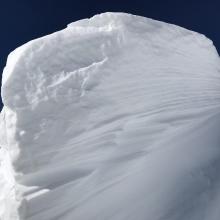
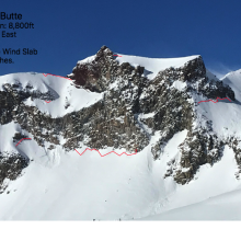
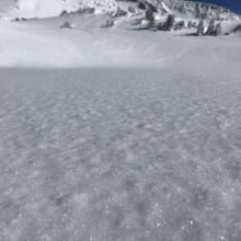
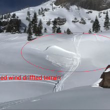
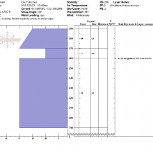
The mission was to do a crown profile on the Saint Germain Bowl avalanche that occurred on Dec 30th. Ascending a ridge to the crown of the avalanche, the snowpack showed signs of instabilities. Shooting cracks and small test slopes shed easily, releasing about 10cm (5in) of wind packed snow. I counted a total of seven individual crown lines, on steep leeward east facing slopes along Casaval Ridge, Green Butte, and Sargents Ridge. A recently triggered wind slab was observed near treeline on an east facing convex depression where snow had drifted. Above treeline, conditions were primarily hard pack with some thin ice glaze in places. In protected areas near and below treeline, soft snow exists. The day was sunny with consistent moderate winds.





Date: 12.30.2022
Time: Estimated afternoon of 12/30/22
Observers: Eric Falconer & Michael Madden
Path: Saint Germain Bowl, Old Ski Bowl / Sargents Ridge
Latitude: 41.36937849340144
Longitude: -122.1953343135938
Aspect: East
Slope Angle: 38
Elevation: 8,735ft
Type: hard Slab (HS)
Trigger: Natural
Size: HS-NS-R4-D2-I
Bed Surface: Old snow P / PP 1mm
Weak Layer: New snow interface: 4F / DP 1mm
Slab: P-hardness / Wind packed grains 1mm
Slab Thickness: 3-5ft
Width: 2,484ft
Vertical Fall: 400ft
Start zone: T – East Ridge connecting to Sargents Ridge proper
Terminus: Mid-slope