You are here
Castle Lake

Location Name:
Castle LakeRegion:
Castle LakeDate and time of observation:
Tue, 12/27/2016 - 8:00pmObservation made by:
Professional ObserverLocation Map
United States
41° 13' 19.128" N, 122° 23' 23.856" W
See map: Google Maps
US
Weather Observations
Statistics
Cloud Cover:
25% of the sky covered by cloudsBlowing Snow:
NoPrecipitation:
NoneAccumulation rate:
NoneAir temperature:
Above FreezingAir temperature trend:
WarmingWind Speed:
LightWind Direction:
Southeast


We were pleasantly surprised with the discovery of 10-12 inches of low density snow at the Castle Lake parking lot at 10 a.m.
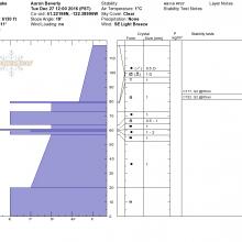
Overalll snowpack conditions were stable, with settled new storm snow well bonded with the old snow rain crust. CT tests yielded stable results.
Areas of possible concern were isolated to steep northerly wind effected slopes in the bowl above Heart Lake just below the top of Middle Peak. Several type 2 avalances have occured in this area, most likely occuring shortly after the last storm cycle. Wind slabs remain on some north easterly aspects of this bowl and could be sensitive to ski triggering or warming trends in the next few days. The bowl was a mix of avalanche bed surface, wind crusts, wind scour, and settled powder in low regions.
Powder hounds will likely find some good skiing over the next couple of days in areas of low sun and wind exposure. Expect melt-freeze crusts on aspects exposed to the sun.
Be prepared for some manzanita avoidance, but overall Castle Lake has a great base and should provide some great skiing after future storm cycles.
Lake is frozen and ready for foot traffic.
Slide Below Middle Peak
Left Peak
Middle Peak