You are here
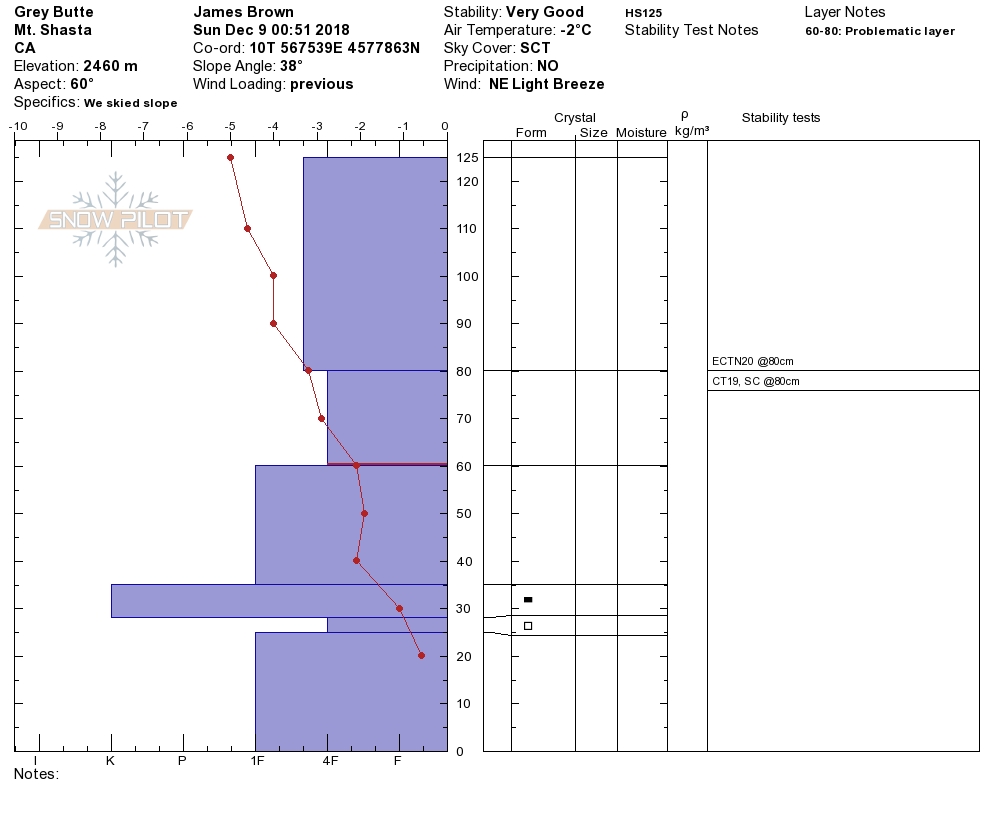
Pit Profile on Gray Butte

Location Name:
Gray ButteRegion:
Mt. ShastaDate and time of observation:
Sun, 12/09/2018 - 12:13pmObservation made by:
PublicLocation Map
96067
Mount Shasta
, CA
United States
41° 20' 58.3728" N, 122° 11' 32.4888" W
See map: Google Maps
California US


Hey Guys,
We were out on Gray Butte digging pits for winter guides training. We found an ice form at the bottom of the snow pack with facets underlying the ice. This layer was completely unreactive. We also found some a reactive layer at what appears to be a storm interface. This produces CTM results but would not propagate. The slope skied great.