You are here
Avalanche Advisory for 2017-12-15 06:42:48
- EXPIRED ON December 16, 2017 @ 6:42 amPublished on December 15, 2017 @ 6:42 am
- Issued by Nick Meyers - Shasta-Trinity National Forest
Bottom Line
LOW avalanche danger remains for all elevations and aspects.
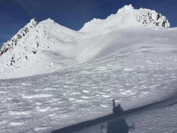
Notable hazards for the Mt Shasta backcountry today include:
*increasing northwest winds near and above treeline.
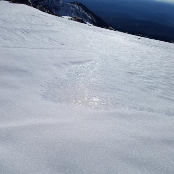
*firm, icy snow surfaces making self-arrest difficult
*numerous exposed and barely covered obstacles.
*rime ice / rockfall
Avalanche Problem 1: Normal Caution
-
Character ?

-
Aspect/Elevation ?

-
Likelihood ?CertainVery LikelyLikelyPossible
 Unlikely
 -
Size ?HistoricVery LargeLargeSmall

Natural and human triggered avalanches are unlikely. Normal caution is advised. Traveling in sheltered terrain that is not affected by wind or on snow covered, sun exposed terrain will provide the safest and most enjoyable soft snow conditions today.
As always:
- Be vigilant.
- Travel with a partner.
- Carry a beacon, shovel, and probe.
- Pay attention to changing snow conditions.
- Keep an eye out for isolated pockets of instability.
Forecast Discussion
A piddly storm moves through tonight. No need to get emotional about this one. Notables for today and the weekend include powerful northwest winds, shallow buried rocks, rime ice and slick and firm snow surfaces. Any skiers and climbers on Saturday and Sunday will likely encounter gale force winds. Hold on to your hats.
We've been talking about our icy snow surfaces a lot lately. This is no joke. A climber slipped and fell yesterday on a low angle slope on the Avalanche Gulch route and took a 600 foot slide for life, unable to self arrest. Minor crampon injuries were suffered.
A few skiers shredded from Lake Helen and nicked a few rocks on the way down.
There are hazards in the backcountry currently, just not in the way of avalanches. Be prepared, know your limitations, come home for the holidays!

Inversions have been the norm for many days on end in the Mt Shasta area. Photo taken yesterday from Bunny Flat area, looking south toward Castle Crags and the Sacramento River Canyon / Photo: Meyers
Recent Observations
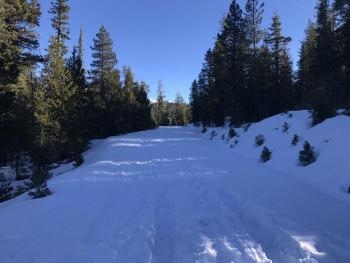
Temperatures this morning near treeline on Mt Shasta are near 50 degrees F and northwest winds are increasing. Yesterday, very warm air temps were experienced at Bunny Flat. Our compact, firm snowpack is indeed decreasing due to warm temperatures. Areas below 7,000 feet host patchy and shallow snow. Variable snow surfaces ranging from softer snow to firm surfaces exist near and below treeline on northerly terrain. Spring-like snow conditions can be found on southerly, sun soaked terrain. Widespread firm, wind scoured snow surfaces remain on many near and above treeline slopes. Rocks present a significant hazard as our snowpack dwindles. Ski and ride with care! Short days and low sun angles have prevented any loose wet avalanche problems.
Weather and Current Conditions
Weather Summary
A fast moving and short lived front tracks toward the area today. Most of its action will reside to the north of us. We may see just a tease of precipitation late today and into the evening with snow levels near 4,500 feet. Stagnant air should mix and valley polution will air out. Colder air moves in tonight giving us a more winter-like feel. Winds will increase later today out of the west and progress to northwest and north tomorrow. Very windy conditions are forecast for this weekend on the mountain. A more active pattern is expected to kick in next week with a somewhat notable system near Wednesday. More on that later!
------------------------------------------------------------------
THIS SEASON PRECIPITATION for MT SHASTA CITY: Since October 1st (the wet season), we have received 5.72 inches of water, normal is 10.68 inches, putting us at 53% of normal. For the month of December, we have received .18 inches of water, normal is 3.32 inches, which is 5% of normal. And finally for the year of 2017, we received 44.71 inches of water, normal is 38.68 inches, putting us at 115% of normal.
Always check the weather before you attempt to climb Mt Shasta. Further, monitor the weather as you climb. Becoming caught on the mountain in any type of weather can compromise life and limb. Be prepared.
24 Hour Weather Station Data @ 5:00 AM
| Weather Station | Temp (°F) | Wind (mi/hr) | Snow (in) | Comments | ||||||||
|---|---|---|---|---|---|---|---|---|---|---|---|---|
| Cur | Min | Max | Avg | Avg | Max Gust | Dir | Depth | New | Water Equivalent | Settlement | ||
| Mt. Shasta City (3540 ft) | 37 | 28 | 51 | 38 | 3 | N | ||||||
| Sand Flat (6750 ft) | 37 | 32 | 51 | 40 | 14 | 0 | 0 | 1 | ||||
| Ski Bowl (7600 ft) | 52 | 48 | 60 | 54 | 18 | 0 | 0 | 2 | ||||
| Gray Butte (8000 ft) | 50 | 44 | 63 | 54 | 8 | 31 | ENE | |||||
| Castle Lake (5870 ft) | 50 | 43 | 52 | 48 | 8 | 5 | 2 | |||||
| Mount Eddy (6509 ft) | 46 | 38 | 58 | 50 | 2 | 9 | WSW | 10 | 2 | 2 | ||
| Ash Creek Bowl (7250 ft) | ||||||||||||
| Ash Creek Ridge (7895 ft) |
Two Day Mountain Weather Forecast
Produced in partnership with the Medford NWS
| For 7000 ft to 9000 ft | |||
|---|---|---|---|
|
Friday (4 a.m. to 10 p.m.) |
Friday Night (10 p.m. to 4 a.m.) |
Saturday (4 a.m. to 10 p.m.) |
|
| Weather | Partly sunny. Slight chance of snow showers after 4pm. | Partly cloudy. Slight chance of snow showers before 10pm. | Mostly sunny, breezy |
| Temperature (°F) | 48 | 27 | 35 |
| Wind (mi/hr) | West 10-15 mph, gusts higher | Northwest 15-20 mph, increasing | North 20-25 mph |
| Precipitation SWE / Snowfall (in) | / 0-.5 | / 0-.5 | / 0 |
| For 9000 ft to 11000 ft | |||
| Friday | Friday Night | Saturday | |
| Weather | Partly sunny with a slight chance of snow showers after 4pm, windy | Mostly cloudy, becoming mostly clear, windy. | Mostly sunny, very windy |
| Temperature (°F) | 41 | 20 | 28 |
| Wind (mi/hr) | West 20-25 mph | Northwest 0-.5 | North 45-50 mph |
| Precipitation SWE / Snowfall (in) | / 0-.5 | / 0-.5 | / 0 |


