You are here
Avalanche Advisory for 2017-12-25 07:00:11
- EXPIRED ON December 26, 2017 @ 7:00 amPublished on December 25, 2017 @ 7:00 am
- Issued by Andrew Kiefer - Mt Shasta Avalanche Center
Bottom Line
LOW avalanche danger exists on all aspects and at all elevations. Normal caution is advised. Many shallow snowpack hazards exist. Use extreme caution in steep, upper elevation terrain where icy and firm snow surfaces are widespread.
Avalanche Problem 1: Normal Caution
-
Character ?

-
Aspect/Elevation ?

-
Likelihood ?CertainVery LikelyLikelyPossible
 Unlikely
 -
Size ?HistoricVery LargeLargeSmall

Generally safe avalanche conditions exist in the backcountry. Use normal caution:
*Watch for isolated slabs.
*Ski and ride one at a time in avalanche terrain.
*Don't regroup in run out zones.
*Basic avalanche rescue skills are always essential when you travel in avalanche terrain.
Isolated slabs are generally related to wind and terrain: look for places where small areas of drifting have occurred and firm layers of surface snow overlie softer layers. Often this will occur on the lee side of ridges, in terrain depressions, on convex terrain features, and in the lee of isolated bands of trees.
Forecast Discussion
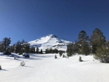
Merry Christmas! Gorgeous weather is expected today. A useable snowpack exists on Mount Shasta and in the Ash Creek Butte zone. Conditions are certainly challenging, and coverage is sparse. Be on the lookout for rocks, stumps, and other shallowly buried objects. It is hard to avoid firm and icy snow surfaces near and above treeline. A slide for life could easily occur in these conditions. Be sure to bring an ice axe, crampons, and a helmet if you plan to venture into steep alpine terrain.
Recent Observations
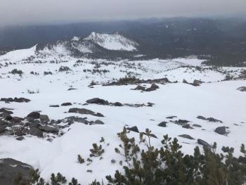
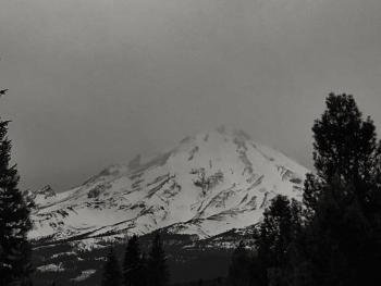
Yesterday brought dark grey skies, snow flurries, and strong northwest winds. Precipitation began just after 11am. No snow accumulation was observed during an outing to the Old Ski Bowl. Clouds engulfed the upper mountain for the entire day. Snow surfaces were variable. Most slopes are scoured down to an old, slick melt-freeze crust. On north and east facing slopes sheltered from wind, 4 inches of low-density snow sits atop a firm and supportable snowpack. The best skiing and riding is on these aspects near and below treeline. Bare ground is exposed in many avalanche path start zones and popular ski runs on the south side of Mount Shasta. No signs of instability have been observed since our recent storm ended last Wednesday.
Weather and Current Conditions
Weather Summary
Today will be sunny and clear. Highs will reach 40 degrees at 6,000ft. Northwest winds will be moderate with strong gusts at upper elevations. Winds will shift to the west overnight. A weak frontal system could bring partly cloudy skies tomorrow, but no precipitation. High pressure will follow, and dry, mild weather is set for the remainder of the week.
---------------------------------------------------
THIS SEASON PRECIPITATION for MT SHASTA CITY: Since October 1st (the wet season), we have received 5.83 inches of water, normal is 13.41 inches, putting us at 43% of normal. For the month of December, we have received .29 inches of water, normal is 6.05 inches, which is 5% of normal. And finally for the year of 2017, we received 44.82 inches of water, normal is 41.41 inches, putting us at 108% of normal.
Always check the weather before you attempt to climb Mt Shasta. Further, monitor the weather as you climb. Becoming caught on the mountain in any type of weather can compromise life and limb. Be prepared.
24 Hour Weather Station Data @ 4:00 AM
| Weather Station | Temp (°F) | Wind (mi/hr) | Snow (in) | Comments | ||||||||
|---|---|---|---|---|---|---|---|---|---|---|---|---|
| Cur | Min | Max | Avg | Avg | Max Gust | Dir | Depth | New | Water Equivalent | Settlement | ||
| Mt. Shasta City (3540 ft) | 29 | 29 | 43 | 37 | 1 | N | ||||||
| Sand Flat (6750 ft) | 35 | 32 | 38 | 35 | 15 | 0 | 0 | 0 | ||||
| Ski Bowl (7600 ft) | 30 | 30 | 37 | 34 | 19 | 0 | 0 | 0 | ||||
| Gray Butte (8000 ft) | 29 | 29 | 36 | 32 | 17 | 37 | NW | |||||
| Castle Lake (5870 ft) | 35 | 35 | 42 | 38 | 1 | 0 | 0 | |||||
| Mount Eddy (6509 ft) | 29 | 29 | 41 | 36 | 1 | 7 | WSW | 11 | 0 | 0 | ||
| Ash Creek Bowl (7250 ft) | station down | |||||||||||
| Ash Creek Ridge (7895 ft) | station down |
Two Day Mountain Weather Forecast
Produced in partnership with the Medford NWS
| For 7000 ft to 9000 ft | |||
|---|---|---|---|
|
Monday (4 a.m. to 10 p.m.) |
Monday Night (10 p.m. to 4 a.m.) |
Tuesday (4 a.m. to 10 p.m.) |
|
| Weather | Sunny | Partly Cloudy | Mostly Sunny |
| Temperature (°F) | 41 | 30 | 42 |
| Wind (mi/hr) | Northwest 5-10 mph | Northwest 5-10 mph | West/Northwest 6-13 mph, Gusting 20 mph |
| Precipitation SWE / Snowfall (in) | / 0 | / 0 | / 0 |
| For 9000 ft to 11000 ft | |||
| Monday | Monday Night | Tuesday | |
| Weather | Sunny and Windy | Partly Cloudy and Windy | Mostly Sunny and Windy |
| Temperature (°F) | 29 | 27 | 28 |
| Wind (mi/hr) | West/Northwest 25-30 mph, Gusting 55 mph | West 0 | West/Northwest 20-30 mph, Gusting 60 mph |
| Precipitation SWE / Snowfall (in) | / 0 | / 0 | / 0 |


