You are here
Avalanche Forecast for 2020-02-17 06:30
- EXPIRED ON February 18, 2020 @ 6:30 amPublished on February 17, 2020 @ 6:30 am
- Issued by Aaron Beverly - Mount Shasta Avalanche Center
Bottom Line
Avalanche danger is LOW. Clear, dry weather will prevail for the foreseeable future. Be prepared for a firm snowpack. Bring an ice axe, crampons, and helmet if ascending high into the alpine. Beware of falling rock above Helen Lake.
Avalanche Problem 1: Normal Caution
-
Character ?

-
Aspect/Elevation ?

-
Likelihood ?CertainVery LikelyLikelyPossible
 Unlikely
 -
Size ?HistoricVery LargeLargeSmall

Use your common sense in the backcountry. Carry the proper equipment for avalanche rescue: a beacon, shovel, and probe. Prepare for firm conditions above treeline. Bring an ice axe, crampons, and helmet if ascending steep slopes. Solar radiation and warmer temperatures may loosen the hold the snowpack has on rocks. Beware of rock fall above Helen Lake.
Forecast Discussion
Suffering from those winter blues? Does the forecast sound like a scratched record? It is feeling like spring in February, but don't plant those tomatoes yet. Winter may still be around the corner. Remember to stay sunny through the winter doldrums. Look for brief periods of corn skiing. Go summit the mountain. Get out and enjoy it. Or head north.
Recent Observations
In the last 24 hours, Mount Shasta has received no new snow. Temperatures poked above freezing briefly reaching a high of 35 deg F. Winds have been northwest and moderate and light and variable.
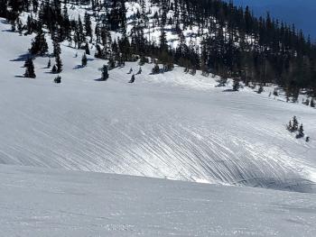
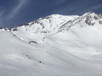
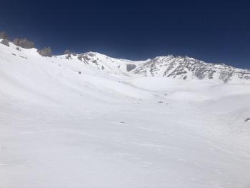
The snowpack is taking on late spring characteristics - shallow, firm, and sun-cupped, with old wind textures. Cinders, twigs, and other detritus from wind events litter the snow surface. Recent signs of rock fall is evident above Helen Lake.
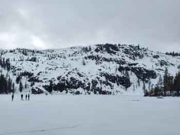
The ice on Castle Lake is still supportable though look out for weak spots along the edges. Snow surfaces were soft and corny. The non-discriminating skier may still find some worthy skiing there.
No signs of instability have been seen.
Weather and Current Conditions
Weather Summary
The weather forecast discussion for the week is full of ridges, troughs, and fronts. What it means for us is dry, clear weather accompanied by cold nights (low 20's) and relatively warm days (high 30's / low 40's) at mid-elevations. Prepare for narrow windows of spring skiing conditions.
An interlude of wet weather may grace our presence late Saturday.
24 Hour Weather Station Data @ 5:00 AM
| Weather Station | Temp (°F) | Wind (mi/hr) | Snow (in) | Comments | ||||||||
|---|---|---|---|---|---|---|---|---|---|---|---|---|
| Cur | Min | Max | Avg | Avg | Max Gust | Dir | Depth | New | Water Equivalent | Settlement | ||
| Mt. Shasta City (3540 ft) | 30 | 30 | 54 | 41 | 3 | |||||||
| Sand Flat (6750 ft) | 29 | 28 | 36 | 32 | 48 | 0 | 0 | 0 | ||||
| Ski Bowl (7600 ft) | 31.5 | 26 | 35 | 30.5 | 64 | 0 | 0 | 0 | ||||
| Gray Butte (8000 ft) | 31.5 | 25.5 | 33.5 | 28.5 | 15 | 49 | NW | |||||
| Castle Lake (5870 ft) | 26 | 26 | 42 | 33 | 30 | 0 | 0 | |||||
| Mount Eddy (6509 ft) | 28 | 25.5 | 36.5 | 30.5 | 2 | 11 | SSE | 46 | 0 | 0 | ||
| Ash Creek Bowl (7250 ft) | down | |||||||||||
| Ash Creek Ridge (7895 ft) | down |
Two Day Mountain Weather Forecast
Produced in partnership with the Medford NWS
| For 7000 ft to 9000 ft | |||
|---|---|---|---|
|
Monday (4 a.m. to 10 p.m.) |
Monday Night (10 p.m. to 4 a.m.) |
Tuesday (4 a.m. to 10 p.m.) |
|
| Weather | Sunny. | Clear. | Sunny. |
| Temperature (°F) | 35 | 19 | 42 |
| Wind (mi/hr) | Northeast 5-10 | Northeast 5-10 | Northeast 5-10 |
| Precipitation SWE / Snowfall (in) | 0.00 / 0 | 0.00 / 0 | 0.00 / 0 |
| For 9000 ft to 11000 ft | |||
| Monday | Monday Night | Tuesday | |
| Weather | Sunny. Windy. | Clear. Diminishing winds. | Sunny. |
| Temperature (°F) | 17 | 9 | 19 |
| Wind (mi/hr) | North 25-30 | Northwest 5-10 | Northwest 5-10 |
| Precipitation SWE / Snowfall (in) | 0.00 / 0 | 0.00 / 0 | 0.00 / 0 |
Season Precipitation for Mount Shasta City
| Period | Measured (in) | Normal (in) | Percent of Normal (%) |
|---|---|---|---|
| From Oct 1, 2024 (the wet season) | 12.90 | 26.21 | 49 |
| Month to Date (since Apr 1, 2025) | 0.12 | 3.94 | 3 |
| Year to Date (since Jan 1, 2025) | 3.97 | 11.00 | 36 |


