You are here
Avalanche Forecast for 2020-02-25 06:15
- EXPIRED ON February 26, 2020 @ 6:15 amPublished on February 25, 2020 @ 6:15 am
- Issued by Ryan Sorenson - Mount Shasta Avalanche Center
Bottom Line
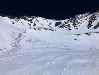
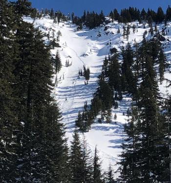
Sunny and dry weather will continue. LOW avalanche danger exists with normal caution advised. Sliding falls on firm snow surfaces remain a hazard. A slip or fall on steep icy slopes could be difficult to arrest. Bring an ice axe, crampons, and helmet if ascending steep terrain. Beware of falling rock.
Avalanche Problem 1: Normal Caution
-
Character ?

-
Aspect/Elevation ?

-
Likelihood ?CertainVery LikelyLikelyPossible
 Unlikely
 -
Size ?HistoricVery LargeLargeSmall

Moderate wind and below-freezing temperatures have allowed decent surface refreeze. Anticipate firm snow surfaces this morning. It will quickly soften as the wind dies off, and temperatures rise. However, shaded northerly aspects, wind-exposed, and higher elevation slopes may remain firm all day. Sliding falls on firm snow surfaces is the primary concern. Bring an ice axe, crampons, and helmet if ascending steep slopes. Beware of rockfall if traveling in the alpine as solar radiation, warmer temperatures, and wind may loosen the hold the snowpack has on rocks.
Recent Observations
Our snowpack continues to take on late spring characteristics. Overall the snowpack is stable, shallow, firm, and variable. Gullies contain cinders blown from exposed areas. A layer of soft corn snow has been forming on wind-protected, sun-exposed aspects during the late morning to mid afternoon hours.
In the last 24 hours:
- Mount Shasta has received no new snow.
- Temperatures have reached a high of 37 deg F at 4 PM and have dropped below freezing around 1 AM.
- Wind speeds decreased after 9 AM, averaging 9 mi/hr on Gray butte.
Weather and Current Conditions
Weather Summary
Similar to yesterday, the weather will be full of sunshine as a dry air mass has moved in for the workweek. Wind should begin to decrease today, especially for the Eddies and lower elevations on Mount Shasta. Cold nights and mornings will quickly give way to warmer temperatures during this dry week. These pronounced temperature swings will allow for adequate windows of spring skiing conditions. There is a chance for fresh snow to arrive late this weekend into early next week.
24 Hour Weather Station Data @ 3:00 AM
| Weather Station | Temp (°F) | Wind (mi/hr) | Snow (in) | Comments | ||||||||
|---|---|---|---|---|---|---|---|---|---|---|---|---|
| Cur | Min | Max | Avg | Avg | Max Gust | Dir | Depth | New | Water Equivalent | Settlement | ||
| Mt. Shasta City (3540 ft) | 34 | 30 | 56 | 42.5 | 4 | |||||||
| Sand Flat (6750 ft) | 27 | 27 | 41 | 35 | 44 | 0 | 0 | 0 | ||||
| Ski Bowl (7600 ft) | 29 | 29 | 41 | 35.5 | 63 | 0 | 0 | 0 | ||||
| Gray Butte (8000 ft) | 31.5 | 28.5 | 37.5 | 34 | 9 | 49 | SE | |||||
| Castle Lake (5870 ft) | 31 | 31 | 40 | 35.5 | 29 | 0 | 0 | |||||
| Mount Eddy (6509 ft) | 35.5 | 33 | 39 | 36 | 3 | 16 | SE | 46 | 0 | 0 | ||
| Ash Creek Bowl (7250 ft) | down | |||||||||||
| Ash Creek Ridge (7895 ft) | down |
Two Day Mountain Weather Forecast
Produced in partnership with the Medford NWS
| For 7000 ft to 9000 ft | |||
|---|---|---|---|
|
Tuesday (4 a.m. to 10 p.m.) |
Tuesday Night (10 p.m. to 4 a.m.) |
Wednesday (4 a.m. to 10 p.m.) |
|
| Weather | Sunny. | Clear. | Sunny. |
| Temperature (°F) | 49 | 33 | 52 |
| Wind (mi/hr) | Northeast 5-10 | North 0-5 | Northwest 0-5 |
| Precipitation SWE / Snowfall (in) | 0.00 / 0 | 0.00 / 0 | 0.00 / 0 |
| For 9000 ft to 11000 ft | |||
| Tuesday | Tuesday Night | Wednesday | |
| Weather | Sunny. | Clear. | Sunny. |
| Temperature (°F) | 34 | 31 | 31 |
| Wind (mi/hr) | Northwest 20-25 | Northwest 10-15 | West 20-25 |
| Precipitation SWE / Snowfall (in) | 0.00 / 0 | 0.00 / 0 | 0.00 / 0 |
Season Precipitation for Mount Shasta City
| Period | Measured (in) | Normal (in) | Percent of Normal (%) |
|---|---|---|---|
| From Oct 1, 2024 (the wet season) | 12.90 | 28.42 | 45 |
| Month to Date (since Apr 1, 2025) | 0.12 | 6.15 | 2 |
| Year to Date (since Jan 1, 2025) | 3.97 | 13.21 | 30 |


