

You are here
Avalanche Forecast for 2020-03-10 06:00
- EXPIRED ON March 11, 2020 @ 6:00 amPublished on March 10, 2020 @ 6:00 am
- Issued by Aaron Beverly - Mount Shasta Avalanche Center
Bottom Line
Avalanche danger is LOW. Exercise normal caution. Spring-like conditions will prevail until the weekend. Beware of falling rock.


Avalanche Problem 1: Normal Caution
-
Character ?

-
Aspect/Elevation ?

-
Likelihood ?CertainVery LikelyLikelyPossible
 Unlikely
 -
Size ?HistoricVery LargeLargeSmall

Avalanche danger is LOW. Exercise normal caution:
- Watch for isolated wind slabs.
- Bring and be prepared to use your avalanche rescue tools.
- Practice safe travel techniques when entering avalanche terrain.
Forecast Discussion
Recent Observations
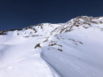
In the last 24 hours on Mount Shasta, near treeline temperatures ranged from 18 to 34 degrees. Winds were light and variable with gusts up to 25 mi/hr.
The weekend storm freshened up our beleaguered snowpack. Storm totals near treeline on the south side were around 5 inches. On the northside, the height of storm snow was a consistent 8 inches from 6,000 to 7,800 feet.
The surface snow has begun to see effects of wind and solar radiation as it transitions to above treeline elevations. Fresh snow is thinner, more chalky, and moist. Low density snow can still be found in lee areas and gullies.
On the northeast side, there is snow on the road 10 miles out from the Brewer Creek Trailhead. The height of snow below treeline is actually more than above (55 inches vs. 31 inches). The above treeline snowpack has endured a long season of hammering winds.
No notable signs of instability have been seen in the last couple of days.
Weather and Current Conditions
Weather Summary
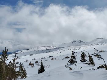
A spring-like cycle of weather returns today. Expect warm, sunny days and cool, clear nights until the weekend. Near treeline temperatures will reach near 50 degrees in the afternoon, and fall to just below freezing during the late night hours. Winds look to be light even above treeline for the next couple of days.
Wetter, cooler weather returns Saturday.
24 Hour Weather Station Data @ 4:00 AM
| Weather Station | Temp (°F) | Wind (mi/hr) | Snow (in) | Comments | ||||||||
|---|---|---|---|---|---|---|---|---|---|---|---|---|
| Cur | Min | Max | Avg | Avg | Max Gust | Dir | Depth | New | Water Equivalent | Settlement | ||
| Mt. Shasta City (3540 ft) | 37 | 34 | 43 | 38.5 | 1 | N | ||||||
| Sand Flat (6750 ft) | 21 | 21 | 36 | 28 | 38 | 0 | 0 | 1 | ||||
| Ski Bowl (7600 ft) | 26.5 | 18.5 | 34.5 | 26.5 | 60.9 | 0 | 0 | 1.3 | ||||
| Gray Butte (8000 ft) | 25.5 | 18 | 30 | 25 | 7 | 25 | W | |||||
| Castle Lake (5870 ft) | 30.5 | 25.5 | 47.5 | 33.5 | 31.9 | 0 | 0.3 | |||||
| Mount Eddy (6509 ft) | 22.5 | 22.5 | 33 | 26.5 | 2 | 7 | WSW | 47.1 | 0 | 0 | ||
| Ash Creek Bowl (7250 ft) | down | |||||||||||
| Ash Creek Ridge (7895 ft) | down |
Two Day Mountain Weather Forecast
Produced in partnership with the Medford NWS
| For 7000 ft to 9000 ft | |||
|---|---|---|---|
|
Tuesday (4 a.m. to 10 p.m.) |
Tuesday Night (10 p.m. to 4 a.m.) |
Wednesday (4 a.m. to 10 p.m.) |
|
| Weather | Sunny. | Mostly clear. | Sunny. |
| Temperature (°F) | 46 | 31 | 50 |
| Wind (mi/hr) | Northeast 0-5 | Northeast 0-5 | North 0-5 |
| Precipitation SWE / Snowfall (in) | 0.00 / 0 | 0.00 / 0 | 0.00 / 0 |
| For 9000 ft to 11000 ft | |||
| Tuesday | Tuesday Night | Wednesday | |
| Weather | Sunny. | Mostly clear. | Sunny. |
| Temperature (°F) | 26 | 26 | 26 |
| Wind (mi/hr) | South 5-10 | East 5-10 | North 10-15 |
| Precipitation SWE / Snowfall (in) | 0.00 / 0 | 0.00 / 0 | 0.00 / 0 |
Season Precipitation for Mount Shasta City
| Period | Measured (in) | Normal (in) | Percent of Normal (%) |
|---|---|---|---|
| From Oct 1, 2025 (the wet season) | 13.61 | 31.69 | 43 |
| Month to Date (since Mar 1, 2026) | 0.71 | 2.19 | 32 |
| Year to Date (since Jan 1, 2026) | 4.68 | 16.48 | 28 |

