

You are here
Avalanche Advisory for 2016-03-19 06:14:48
- EXPIRED ON March 20, 2016 @ 6:14 amPublished on March 19, 2016 @ 6:14 am
- Issued by Jon Dove - Shasta-Trinity National Forest
Bottom Line
Overall, LOW avalanche danger exists through out the forecast area for all elevations and aspects.
Temperatures will remain above normal today. Increasing clouds, and light to moderate southerly winds will make formation of any loose wet snow instabilities unlikely. Avalanche danger will begin to increase Sunday into Monday with back to back storms in the forecast.
For today, normal caution advised. Watch for unstable snow on isolated steep terrain features.


Avalanche Problem 1: Normal Caution
-
Character ?

The avalanche hazards that have been present over the past couple of days will be less likely to occur today. That is not to say that they are not possible. Unstable snow could still exist on steep, isolated terrain, mainly near and below treeline. Cornices definitely still exist and could fail. Temperatures today will be above normal, but roller balls and pinwheel formation on southerly aspects is only a slim possibility. Increasing clouds and the southerly winds gaining in strength will help keep loose wet instabilities at bay. Normal caution is advised.
Forecast Discussion
Today will see the end of the five day stretch of sun shine that followed last weeks storms. Clouds will increase ahead of the warm front that is scheduled to arrive early Sunday morning. This warm front will be quickly followed by a cold front that will move over our area on Monday. Today will not see much in the way of precipitation as the last gasps of sunshine duke it out with increasing clouds. Sunday will be a wet day with 0.7 inches of water evenly distributed over the course of the day. The precipitation will then taper off in the evening providing a break between systems. The cold front that will push onshore Monday morning will produce heavier precipitation than it's predecessor with forecasts predicting up to 0.9 inches of water. Above normal temperatures will persist for today. Sunday will be cooler with temperatures falling even further on Monday. Snow levels with Sunday's system will start off high, around 7,000-7,500 feet, then drop as the storm passes through. Mondays' storm will be noticeably colder with snow levels dropping to near 4,000 feet. Winds will be light to moderate for today coming out of a southerly direction. They will increase late tonight as the approaching storms sweeps our way.
Climbers, this weekend doesn't look favorable for a summit attempt. The upper mountain will become shrouded in clouds today, and they will only thicken as the day progresses with an approaching storm. Poor visibility has been the cause of many disoriented and lost climbers in the past. The climbing season is just beginning and their is plenty of time for good conditions and weather. Play it safe, we want you to come back alive!
THIS SEASON PRECIPITATION for MT SHASTA CITY: Since October 1st (the wet season), we have received 35.35 inches of water, normal is 33.55 inches, putting us at 105% of normal. For the month of March we've received 9.83 inches of water, normal is 4.05 inches, putting us at 242% of normal, and finally... for the year of 2016 we've received 25.86 inches of water, normal is 18.34 inches, putting us at 141% of normal.
Recent Observations
Yesterday was another warm one, although not quite as warm as Thursday. Temperatures will remain above normal today, however increasing clouds and moderate southerly winds will reduce the possibility of loose wet snow instabilities. Despite the generous helping of sunshine this week, above treeline temperatures have been staying cool enough to prolong variable snow conditions. Over the past couple of days everything from wind pack powder in gully bottoms, smooth chalky snow, sastrugi, scoured ridge tops, and wind exposed old crusts and icy patches have been reported. In typical Mt Shasta fashion the gullies and depressions have been harboring some decent snow near and above treeline. It is common to find this type of variability on Mt. Shasta when you have a bought of stormy weather followed by several days of sun shine and warm temperatures. That being said, five days of good weather has been unable to fully settle and consolidate the snow. Boot penetration of up to 30 cm is still prevalent as the snow is still generally soft. Rain will help to tamp the snow down from just below the treeline at 7,500 feet and lower with Sunday's storm.
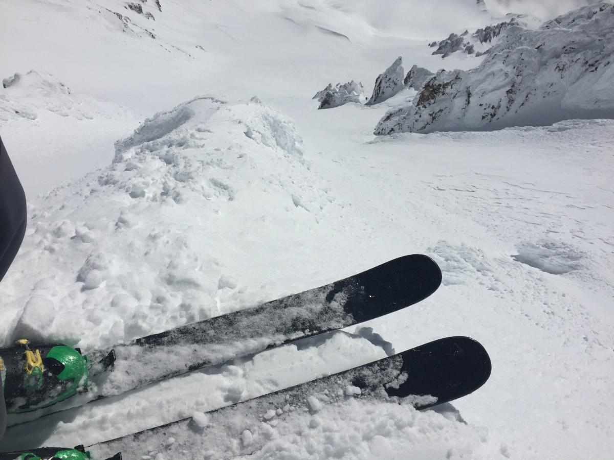
Conditions in the Trinity Chutes can be seen in photos below that were taken this past Wednesday. The snow was described as generally pretty smooth and semi-soft, with sections of chalky wind affected snow. Higher, more wind exposed areas near ridge tops provided breeding grounds for chicken heads, icy knobs, and the like. Rime ice has formed on most rock outcroppings and will thicken with the coming storms. These will pose a potential hazard to climbers next week when we return to sunny skies and warming temperatures. Chucks of ice will begin to peel off of rocks and tumble down slope. As for now, however, this will not be a concern.
Looking down the Trinity Chutes on March 16th.- Photo: Shane Rathbun
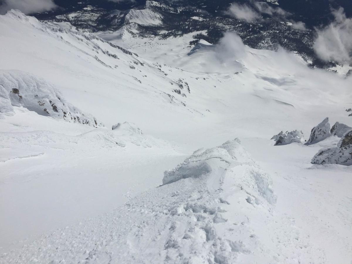
Trinity Chutes, March 16th, Avalanche Gulch below - Photo: Shane Rathbun
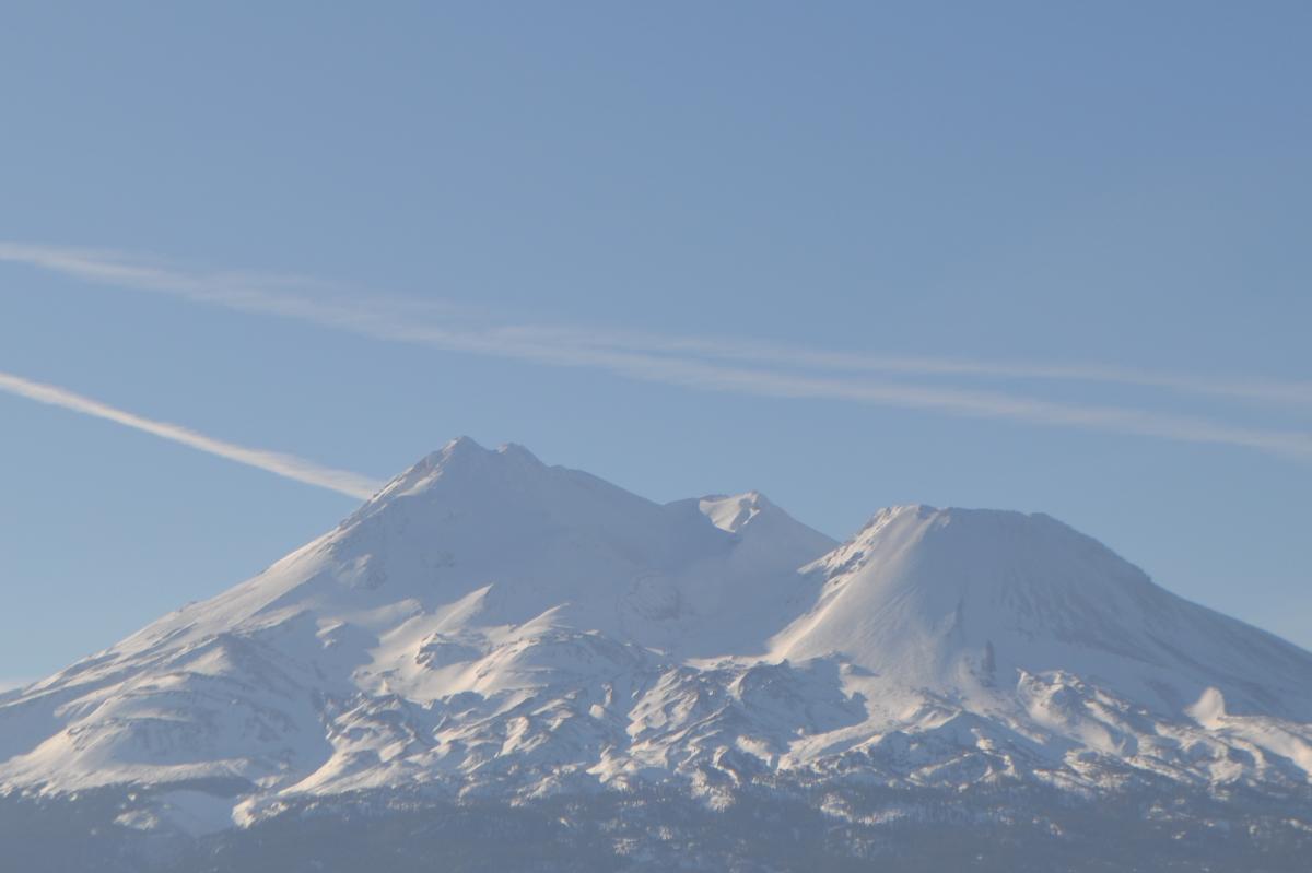
The North side of Mt Shasta, March 17th. - Photo: Zack (a.k.a. Beaver Chief)
-----------------------------------------------------------------------------------------------------------------------------------------------------------
LOCAL AREA ROAD, NORDIC, AND SNOWMOBILE PARK STATUS:
The Sand Flat cross country ski trails are in good shape and ready for your cross country skis and snow shoes. These are backcountry routes marked with blue diamonds on trees. Trails are not groomed. Snow shoers, please blaze a parallel trail to cross country skiers staying out of the skin track. These trails can be accessed via the Everett Memorial Highway. Thank you, and enjoy!
The Mt. Shasta Nordic Center is open! These beautiful, groomed trails can be accessed via the Ski Park Highway. http://www.mtshastanordic.org
The Pilgrim Creek & Deer Mountain Snowmobile Parks are open! Trails have not been groomed in the past week and a half due to constant deep snow fall. Head to our "Education" tab on our website and find the snowmobile section for trail information, grooming status, and other sledder resources.
The Castle Lake Road is CLOSED at the gate. The culvert blew out and we do not know when it will be repaired. The Everett Memorial Highway is plowed to Bunny Flat and currently mostly snow free until about Red Fir Flat up.
The Five Red Flags of Avalanche Danger any time of year include: 1) Recent/current avalanche activity 2) Whumphing sounds or shooting cracks 3) Recent/current heavy snowfall 4) Strong winds transporting snow 5) Rapid warming or rain on snow.
Weather and Current Conditions
Weather Summary
Good Morning! In Mt Shasta City at 0500, we have a current temperature of 45 F, 12 degrees warmer than yesterday at this time. Skies are overcast with calm wind.
On Mt Shasta (South Side) in the last 24 hours...
Old Ski Bowl - 7,600 feet, the current temperature is 37 degrees F. Snow on the ground totals 161 inches with no new snow and 3 inches of settlement. Temperatures have ranged from 35 F to 53 F.
Gray Butte - 8,000 feet, the current temperature is 34 degrees F. Temperatures have ranged from 34 F to 46 F. Winds have been light and westerly in direction averaging 5-10 mph with a gust to 14 mph, W.
Mt Eddy Range (West side of Interstate-5)...
Castle Lake - 5,600 feet, the current temperature is 40 degrees. Temperatures have ranged from 40 F to 60 F. Snow on the ground totals 78 inches with no new snow and 3 inches of settlement.
Mt Eddy - 6,500 feet, the current temperature is 37 degrees F. Temperatures have ranged from 34 F to 52 F. Snow on the ground measures 91 inches with no new snow and 3 inches of settlement. Winds have been southerly in nature with an average of 2 mph, and a maximum gust of 9 mph, SSW.
Always check the weather before you attempt to climb Mt Shasta. Further, monitor the weather as you climb. Becoming caught on the mountain in any type of weather can compromise life and limb. Be prepared.
| 0600 temperature: | 35 |
| Max. temperature in the last 24 hours: | 54 |
| Average wind direction during the last 24 hours: | Westerly |
| Average wind speed during the last 24 hours: | 5-10 mi/hr |
| Maximum wind gust in the last 24 hours: | 14 (Gray Butte) mi/hr |
| New snowfall in the last 24 hours: | 0 inches |
| Total snow depth: | 105 inches |
Two Day Mountain Weather Forecast
Produced in partnership with the Medford NWS
| For 7000 ft to 9000 ft | |||
|---|---|---|---|
|
Saturday (4 a.m. to 10 p.m.) |
Saturday Night (10 p.m. to 4 a.m.) |
Sunday (4 a.m. to 10 p.m.) |
|
| Weather | Partly cloudy this morning then becoming mostly cloudy with a slight chance of rain showers, 20%. | Mostly cloudy with a slight chance of rain showers in the evening, then chance of rain after midnight. Chance of precipitation 40%. Breezy | Cloudy with rain and snow showers. Windy |
| Temperature (°F) | 46 | 33 | 39 |
| Wind (mi/hr) | Southeast 10-15 mph with gust up to 30 this afternoon. | South/southeast 10-15 mph increasing to 15-25 mph after midnight. | South 10-15 mph |
| Precipitation SWE / Snowfall (in) | / 0 | / 0 | / 1-3 |
| For 9000 ft to 11000 ft | |||
| Saturday | Saturday Night | Sunday | |
| Weather | Partly cloudy this morning, then becoming mostly cloudy with a 20% chance of snow showers in the afternoon. Breezy. | Mostly cloudy with a chance of snow showers before 11 pm, then a chance of snow after 11 pm. Windy. | Cloudy with snow before 11 am, then snow showers after 11 am. The snow could be heavy at times. Windy with wind chill values as low as -4. |
| Temperature (°F) | 32 | 24 | 24 |
| Wind (mi/hr) | South/southwest 15-20 mph with gusts to 35 | South 0 | South/southwest 50-55 mph |
| Precipitation SWE / Snowfall (in) | / 0 | / 1-2 | / 9-13 |

