

You are here
Avalanche Advisory for 2018-03-27 06:12
- EXPIRED ON March 28, 2018 @ 6:12 amPublished on March 27, 2018 @ 6:12 am
- Issued by Aaron Beverly - Mount Shasta Avalanche Center
Bottom Line
Avalanche danger is LOW at all elevations. Warming weather will cause snow surfaces to transition today. Exercise normal caution and continue to watch for isolated wind slabs and loose wet activity.


Avalanche Problem 1: Normal Caution
-
Character ?

-
Likelihood ?CertainVery LikelyLikelyPossible
 Unlikely
 -
Size ?HistoricVery LargeLargeSmall

Generally safe avalanche conditions exist in the backcountry. LOW avalanche danger does not mean NO avalanche danger:
- Watch for isolated wind slabs above treeline on SW-SE aspects where small areas of drifting have occurred and firm layers of surface snow overlie softer layers.
- Warm weather and solar radiation may cause small loose wet avalanches on S/E facing slopes. To avoid, travel when the snow surface is colder and stronger. Plan your trips to avoid crossing on or under very steep sunlit slopes.
Forecast Discussion
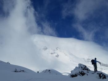
The snowpack is in a state of transition from increasing temperatures and solar radiation. Backcountry travelers should expect to find a mix of moist heavy snow surfaces, sun crusts, and melt-freeze crusts.
If powder is what you seek, you may still encounter it today above treeline and on northerly aspects near treeline, but it won't linger for long.
Recent Observations
Over the last 24 hours, temperatures near treeline have remained near 30 °F except for a brief spike of 56 °F late yesterday morning.
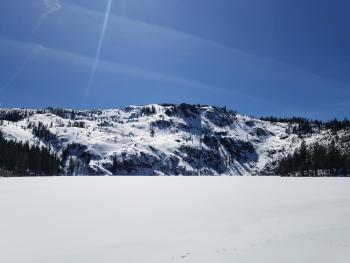
Gray Butte weather station reports calm variable winds over the last 24 hours, though observed winds above treeline were northerly and strong. Snow transported by this wind was sublimating. No significant snow deposition was seen.
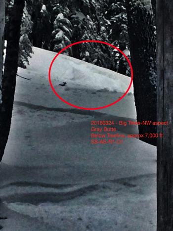
No winds slabs were observed near or above treeline. Some small cornice formations were seen on easterly aspects.
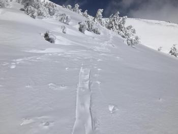
Aside for roller balls on southern and eastern aspects, no signs of instability have been seen. Snow pack is right side up, new snow is well bonded to old snow, and stability is good. Snow surfaces are turning moist and sun and melt-freeze crusts can be found on sun exposed surfaces. Northerly aspects are still holding cold dry snow.
See the most recent observation for details.
Weather and Current Conditions
Weather Summary
High pressure continues to dominate. Expect warm dry conditions through the end of the week. Today, highs will be near 50 degrees at 7000 ft. Above treeline, N winds will average 25-30 mi/hr.
24 Hour Weather Station Data @ 4:00 AM
| Weather Station | Temp (°F) | Wind (mi/hr) | Snow (in) | Comments | ||||||||
|---|---|---|---|---|---|---|---|---|---|---|---|---|
| Cur | Min | Max | Avg | Avg | Max Gust | Dir | Depth | New | Water Equivalent | Settlement | ||
| Mt. Shasta City (3540 ft) | 38 | 27 | 51 | 40.5 | 4 | |||||||
| Sand Flat (6750 ft) | station down | |||||||||||
| Ski Bowl (7600 ft) | 31 | 13.5 | 56 | 28.5 | 90 | 0 | 0 | 1 | ||||
| Gray Butte (8000 ft) | 27.5 | 13.5 | 30.5 | 23.5 | 4 | 18 | ESE | |||||
| Castle Lake (5870 ft) | station down | |||||||||||
| Mount Eddy (6509 ft) | 33 | 16 | 35 | 29 | 2 | 13 | SE | 52.5 | 0 | 1 | ||
| Ash Creek Bowl (7250 ft) | station down | |||||||||||
| Ash Creek Ridge (7895 ft) | station down |
Two Day Mountain Weather Forecast
Produced in partnership with the Medford NWS
| For 7000 ft to 9000 ft | |||
|---|---|---|---|
|
Tuesday (4 a.m. to 10 p.m.) |
Tuesday Night (10 p.m. to 4 a.m.) |
Wednesday (4 a.m. to 10 p.m.) |
|
| Weather | Sunny. | Mostly clear. | Mostly sunny. |
| Temperature (°F) | 50 | 32 | 53 |
| Wind (mi/hr) | N 5-10 mi/hr | N 5-10 mi/hr | N 10-15 mi/hr |
| Precipitation SWE / Snowfall (in) | / 0 | / 0 | / 0 |
| For 9000 ft to 11000 ft | |||
| Tuesday | Tuesday Night | Wednesday | |
| Weather | Sunny. | Mostly clear. | Mostly sunny. |
| Temperature (°F) | 33 | 31 | 32 |
| Wind (mi/hr) | N 25-30 mi/hr | N 0 | N 30-35 mi/hr |
| Precipitation SWE / Snowfall (in) | / 0 | / 0 | / 0 |
Season Precipitation for Mount Shasta City
| Period | Measured (in) | Normal (in) | Percent of Normal (%) |
|---|---|---|---|
| From Oct 1, 2025 (the wet season) | 15.95 | 34.79 | 46 |
| Month to Date (since Mar 1, 2026) | 5.06 | 5.29 | 96 |
| Year to Date (since Jan 1, 2026) | 10.12 | 19.58 | 52 |

